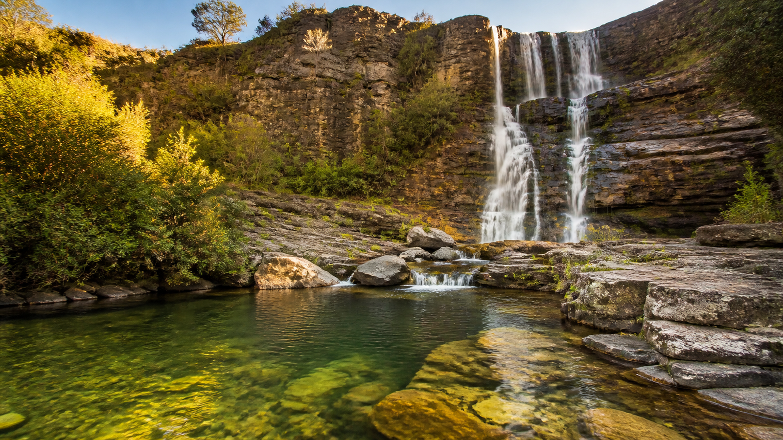
Chapada dos Veadeiros is one of South America’s most awe-inspiring highland landscapes. Located approximately 230 kilometers north of Brasília in the central Brazilian state of Goiás, this ancient UNESCO World Heritage plateau rises high above the Cerrado savanna. It is a land sculpted by time, characterized by shimmering quartz rock outcrops, thunderous canyon waterfalls, and natural river pools so crystal-clear they glow with shades of turquoise and emerald.
For international travelers, visiting Chapada dos Veadeiros offers a completely different perspective of Brazil beyond its coastal beaches and the Amazon rainforest. However, the region is immense, spanning hundreds of square kilometers across three distinct municipalities: Alto Paraíso de Goiás, Vila de São Jorge, and Cavalcante. Without a well-planned route, you can easily spend half your vacation driving back and forth along rough gravel roads instead of swimming beneath pristine waterfalls.
This comprehensive travel guide provides a realistic, field-tested 4 to 6-day itinerary, compares where to stay across the region’s main bases, details the top trails inside and outside the National Park, and delivers essential logistical advice to make your journey seamless and unforgettable.
Why Chapada dos Veadeiros Belongs on Your Brazil Bucket List
Chapada dos Veadeiros sits atop an ancient pre-Cambrian geological formation over a billion years old. Because of its massive underground quartz crystal deposits, the plateau possesses a distinct luminous quality, with crystal shards frequently glittering along hiking paths under the tropical sun.
The region is also the crown jewel of the Brazilian Cerrado—the most biodiverse tropical savanna on the planet. As you hike through the highlands, you travel across expansive grasslands, gallery forests, and dramatic quartzite plateaus that shelter unique wildlife, from toucans and macaws to the elusive maned wolf and giant anteater.
What truly sets Chapada dos Veadeiros apart is its sheer concentration of monumental waterfalls. Rivers carve deep fissures through quartz canyons, creating dramatic multi-tiered cascades, deep swimming holes, and tranquil natural jacuzzis fed by pure mountain springs. Whether you are an experienced trekker tackling 11-kilometer backcountry loops or an easygoing traveler looking to unwind in natural rock pools, the region caters to every level of adventure.
Where to Stay: Alto Paraíso vs. Vila de São Jorge vs. Cavalcante
Choosing where to base yourself is the single most important logistical decision you will make. The three main accommodation hubs each have a distinct character, and staying in just one for your entire trip often involves hours of avoidable daily driving. Here is how the three towns compare:
1. Alto Paraíso de Goiás: The Central Hub
Alto Paraíso is the primary gateway and administrative center of the region. Connected directly to Brasília by a well-paved highway (GO-118), it boasts the most developed infrastructure, including supermarkets, pharmacies, ATMs, gas stations, and a wide array of international and vegetarian restaurants. It also has a well-known esoteric and bohemian culture, reflected in its crystal shops and alternative healing centers.
Best for: Travelers who prioritize comfortable dining, modern pousadas, reliable Wi-Fi, and a central launchpad for southern waterfalls like Cataratas dos Couros and Fazenda São Bento.
2. Vila de São Jorge: The Rustic Trailhead Village
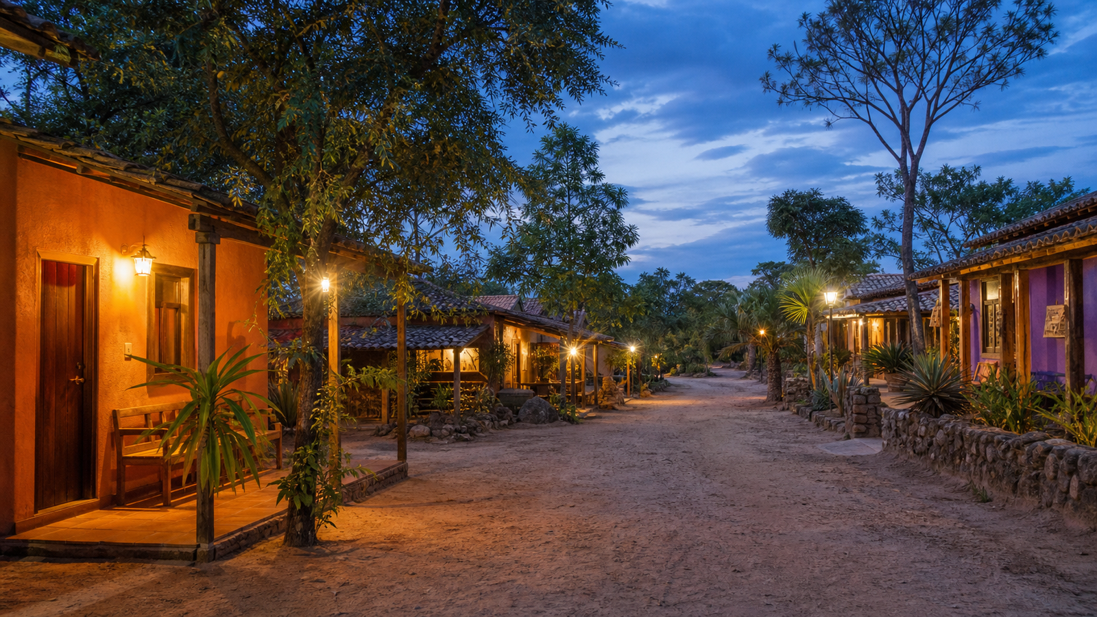
Located 36 kilometers west of Alto Paraíso via the paved GO-239 highway, Vila de São Jorge is a charming village with unpaved sandy streets, rustic lantern-lit bars, and live Forró music in the evenings. Crucially, the main entrance and visitor center of the Parque Nacional da Chapada dos Veadeiros sits right at the edge of the village, allowing you to walk directly to the park gates without getting in your car.
Best for: Hikers, nature lovers, and anyone who enjoys a laid-back, bohemian village vibe where you can walk from your pousada straight onto world-class hiking trails.
3. Cavalcante: The Secluded Northern Frontier
Cavalcante lies approximately 90 kilometers north of Alto Paraíso along paved highway GO-118. It is a quiet, traditional town surrounded by vast expanses of untouched Cerrado. Cavalcante is the sole gateway to the famous Quilombo Kalunga territory—the largest traditional quilombola community in Brazil—and the world-renowned Cachoeira Santa Bárbara.
Best for: Dedicated waterfall enthusiasts wanting early-morning access to Santa Bárbara and deeper cultural immersion away from the crowds.
The Recommended Strategy: For a 5 to 7-day trip, split your stay. Spend 2 to 3 nights in Vila de São Jorge to explore the National Park and Vale da Lua, followed by 2 nights in Cavalcante or Alto Paraíso to take in the northern and southern waterfalls without backtracking.
The Perfect 4 to 6-Day Chapada dos Veadeiros Itinerary
This balanced day-by-day roadmap clusters attractions geographically to minimize road time and optimize your daily energy in the Cerrado climate.
Day 1: Arrival from Brasília & Cerrado Sunset
Fly into Brasília International Airport (BSB) early in the morning, pick up your rental car, and drive 230 km north along BR-010/GO-118 to Alto Paraíso (approx. 3.5 hours). Continue another 36 km along GO-239 to check into your pousada in Vila de São Jorge. In the late afternoon, make a quick roadside stop to admire the iconic panoramic view of Jardim de Maytrea, or hike up the nearby Mirante da Janela for an unforgettable sunset overlooking the distant peaks of the National Park.
Day 2: Parque Nacional da Chapada dos Veadeiros
Dedicate your entire day to the National Park. Walk from São Jorge village to the park entrance by 8:00 AM. Choose either the Trilha dos Saltos (11 km roundtrip) to witness the monumental 120-meter waterfall viewpoint and swim at the 80-meter Garimpão cascade, or the Trilha dos Cânions e Cariocas (11 km roundtrip) to explore dramatic quartz cliffs and multi-tiered swimming pools. Return to São Jorge in the evening for dinner and craft beer.
Day 3: Vale da Lua & Cachoeira Almécegas
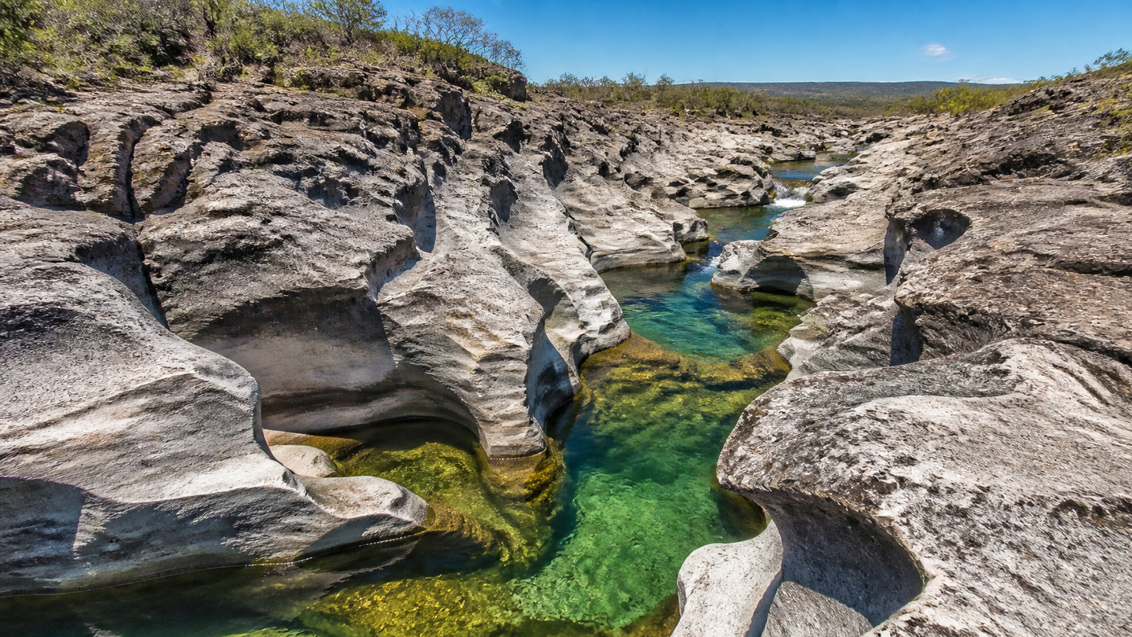
In the morning, drive 10 minutes from São Jorge to Vale da Lua (Moon Valley). Spend two hours wandering among sculpted grey quartz formations shaped like lunar craters by the rushing Rio São Miguel. In the afternoon, drive toward Alto Paraíso and enter Fazenda São Bento to visit Cachoeira Almécegas I—a dramatic cliff drop into a deep canyon—and the wide, gentle swimming pool of Cachoeira Almécegas II.
Day 4: The Wild Cascades of Cataratas dos Couros
Take a full day to explore Cataratas dos Couros, located 53 km southwest of Alto Paraíso (including a 35 km drive on unpaved dirt roads). Couros is one of the most powerful and majestic waterfall complexes in Brazil, featuring a succession of massive cascades, natural rock slides, and vast swimming pools along the Couros River. Hiring a local guide in Alto Paraíso is strongly recommended here to navigate the unmarked network of canyon trails safely.
Day 5: Cavalcante & Cachoeira Santa Bárbara
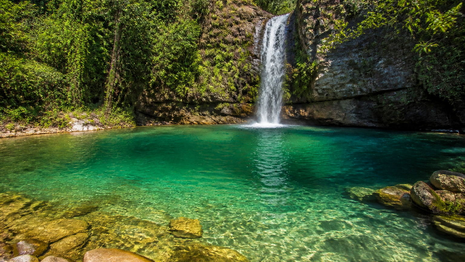
Drive north to Cavalcante and proceed to Comunidade Engenho II in Quilombo Kalunga. Meet your mandatory accredited Kalunga guide at the local tourist center (CAT Engenho II) and hike to Cachoeira Santa Bárbara. The water here is world-famous for its luminous, translucent turquoise color, surrounded by lush vegetation. Pair your visit with the nearby Cachoeira Capivara or Cachoeira Candaru before dining on traditional home-cooked Kalunga food in the village.
Day 6: Loquinhas Emerald Pools & Return to Brasília
Before heading back to the airport, spend a relaxing morning at Complexo de Cachoeiras Loquinhas, located just minutes outside Alto Paraíso. An easy wooden boardwalk leads through protected gallery forest past a series of serene, emerald-green natural plunge pools. Enjoy a leisurely lunch in town, then drive the 230 km back to Brasília for your evening flight.
Top Waterfalls and Trails You Cannot Miss
To help you prioritize your days, here is an in-depth breakdown of the region’s standout natural attractions, including trail lengths, difficulty, and visiting rules:
- Trilha dos Saltos, Carrossel e Corredeiras (Parque Nacional): Approximately 11 km roundtrip (moderate to demanding). Marked with yellow arrows, this trail leads across the highland savanna to the breathtaking viewpoint of Salto do Rio Preto (120m), continues down a steep rocky descent to the base of Salto de 80m (Garimpão) where swimming is allowed, and finishes at the refreshing Corredeiras rapids. Main park trails are self-guided and clearly signposted.
- Trilha dos Cânions e Cachoeira das Cariocas (Parque Nacional): Approximately 11 km roundtrip (moderate). Marked with red arrows, this trail takes you into the heart of Cânion II, where the Rio Preto squeezes through sheer quartz cliffs, before leading to Cachoeira das Cariocas—a magnificent multi-tiered waterfall cascading into a wide, sunlit pool perfect for swimming.
- Vale da Lua (Moon Valley): Located just off GO-239 between Alto Paraíso and São Jorge. An easy 1.2 km roundtrip walk on a private reserve reveals pre-Cambrian rocks carved into smooth, swirling crater shapes by the Rio São Miguel. Calm natural pools are available for swimming in designated areas.
- Cachoeira Santa Bárbara (Cavalcante): Situated inside the historic Quilombo Kalunga territory in Engenho II. The trail is approximately 3 to 5 km roundtrip from the parking area (or shorter if taking local community 4×4 transport). A mandatory community guide hired at CAT Engenho II is strictly required to protect the environment and support local quilombola families. Visits are limited to a timed window to preserve the crystal clarity of the pool.
- Cataratas dos Couros (Alto Paraíso): A wild, free-flowing series of thunderous cascades on the Rio dos Couros. The trail follows the canyon rim and descends to several massive pools (Muralha, Almécegas do Couros, and Parafuso). The dirt road access requires careful driving, and having a local guide ensures you find the safest entry points into the pools.
- Cachoeiras Almécegas I e II (Fazenda São Bento): Located along GO-239. Almécegas I features a 45-meter high cascade pouring down a sheer quartz wall into a deep green pool reached by a steep 1.5 km trail. Almécegas II is an easy 400-meter flat walk to an open, family-friendly waterfall with broad sunbathing rocks.
Practical Logistics: Getting There, Car Rental & Driving
Exploring Chapada dos Veadeiros independently requires basic logistical preparation. Here are the essential travel facts you need to know:
The Gateway: Brasília International Airport (BSB) is the primary entry point for domestic and international flights. From the airport, renting a car is practically mandatory. While long-distance buses connect Brasília to Alto Paraíso, they do not operate to waterfall trailheads, making public transit impractical for sightseeing.
The Route: The drive from Brasília to Alto Paraíso spans roughly 230 kilometers and takes 3 to 3.5 hours via BR-010/BR-020 and GO-118. The highway is fully paved and generally in good condition. The road connecting Alto Paraíso to São Jorge (GO-239) and Cavalcante (GO-118) is also fully paved.
Vehicle Choice: For standard trails in São Jorge, the National Park, Vale da Lua, and Fazenda São Bento, a standard 2WD compact car is sufficient. However, if you plan to drive the 35 km unpaved road to Cataratas dos Couros or the rural tracks inside Quilombo Kalunga in Cavalcante, renting a high-clearance hatchback, crossover, or SUV is strongly advised to prevent scraping the undercarriage on loose rocks and ruts.
Connectivity and Navigation: Mobile phone reception (primarily Vivo and Claro) is available in the town centers of Alto Paraíso, São Jorge, and Cavalcante, but drops out completely once you hit the trails and backcountry roads. Always download offline area maps on Google Maps or Maps.me before departing your pousada.
Best Time to Visit, Weather & Essential Safety Tips
Chapada dos Veadeiros has two distinct seasons, each offering a completely different travel experience:
- Dry Season (May to October): This is widely considered the best time for hiking. Expect sunny days, clear blue skies, virtually zero rainfall, and pleasant evening temperatures. Water clarity is at its absolute peak, ensuring that Santa Bárbara and Loquinhas display their most vibrant turquoise hues. May and June are ideal because the savanna vegetation remains lush green, whereas August and September bring very low humidity and arid conditions.
- Rainy Season (November to April): During the summer rains, the Cerrado blooms with vibrant wildflowers, and the waterfalls thunder at maximum volume. However, afternoon rainstorms are common, which can make dirt roads muddy and increase the risk of flash floods.
Critical Safety Rule — Flash Floods (Tromba d’Água): During the rainy season, sudden heavy storms upstream can cause river levels to rise several meters within minutes. If you are swimming in a canyon or river pool and notice the water level rising, currents accelerating, or the water turning murky brown, exit the riverbed and move to high ground immediately.
Packing Essentials: Sturdy closed-toe hiking shoes or trail runners with good traction are essential for navigating jagged quartz rocks. Bring a dry bag for electronics, biodegradable/reef-safe sunscreen, insect repellent, a wide-brim hat, a reusable water bottle, and sufficient cash in Brazilian Reais (BRL), as card terminals may occasionally lack signal at rural community guide posts.
Frequently Asked Questions
How many days do you need in Chapada dos Veadeiros?
A minimum of 4 full days is recommended to see the top highlights (National Park, Vale da Lua, and Cataratas dos Couros). Staying 5 to 7 days allows you to include Cavalcante and Cachoeira Santa Bárbara without feeling rushed.
Do you need a guide in Chapada dos Veadeiros?
Main trails inside the Parque Nacional da Chapada dos Veadeiros (such as Trilha dos Saltos and Trilha dos Cânions) and Vale da Lua are clearly marked and self-guided. However, Cachoeira Santa Bárbara strictly requires a mandatory local Kalunga guide hired at CAT Engenho II in Cavalcante, and hiring a guide is strongly recommended for Cataratas dos Couros.
Do I need to rent a 4×4 car for Chapada dos Veadeiros?
A 4×4 is not mandatory because paved highways connect Brasília to Alto Paraíso, São Jorge, and Cavalcante. However, a high-clearance car or SUV makes driving the unpaved dirt roads to Cataratas dos Couros and Quilombo Kalunga much easier and prevents undercarriage scrapes.
What is the best month to visit Chapada dos Veadeiros?
The dry season from May to October offers the best conditions for trekking and water clarity. May and June are particularly picturesque because the savanna remains green after the summer rains, with virtually no rain and crystal-clear swimming pools.