Maragogi lies on the northern coast of Alagoas, in Brazil’s Northeast, roughly 125 km from both Maceió and Recife airports, and it is the best-known town in the Costa dos Corais Environmental Protection Area, one of the largest coastal marine protected areas in the country. This Maragogi travel guide comes down to a few essentials: take a catamaran out to the Galés, the natural reef pools 4 to 5 km offshore, on the day with the lowest tide of your trip; walk Moses’ Path (Caminho de Moisés), the sandbar that appears off Barra Grande beach only on extreme low tides; spend an afternoon on the quiet northern beaches (Antunes, Ponta de Mangue, Peroba); try the bolinho de goma, a crumbly tapioca-starch biscuit, in São Bento; and keep at least one day for the Milagres Ecological Route, with its manatee-watching trip in Porto de Pedras, and another for Carneiros Beach, just across the state line in Pernambuco.
We put this guide together in October 2026 and checked the facts against official sources: ICMBio, the federal agency that runs the Costa dos Corais protected area (its management plan and visitor rules), Maragogi City Hall and its official gazette, the Alagoas Public Prosecutor’s Office, the Brazilian Navy, INMET (the national weather institute), IBGE and the hotels’ own websites, plus Alagoas newspapers for the latest news. It covers the town’s history and the protected area, how tides and pool rules work, what each trip costs, when to go, how to get there from Maceió and Recife, a two-to-four-day itinerary and ten hotels with official websites. Where sources disagree, we say so. Tides, prices and rules change, so always double-check the day before.
Quick facts: Maragogi, Alagoas
- Where it is: the far north of the Alagoas coast, on the border with Pernambuco. The municipality covers about 334 km² and had 32,174 residents in the 2022 census (IBGE estimates 33,283 for 2026).
- Why go: the reef pools (Galés, Taocas and Barra Grande) and Moses’ Path, all inside the Costa dos Corais protected area, created in 1997 and managed by ICMBio.
- Golden rule: everything depends on low tide. Pool trips run from 2 hours before to 2 hours after the low tide forecast by the Brazilian Navy for the Port of Maceió. If the low tide is too high, the pools are closed.
- Best time: September to March, when there is little rain and the water tends to be clearer. April to July is the rainy season (June tops 300 mm in Maceió). Peak season: December to February, Carnival and July.
- Getting there: by car or transfer from Maceió Airport (about 124 km, 2 hours) or Recife Airport (about 125 km, 2 hours). Maragogi’s own airport has no commercial flights yet.
- What it costs: pool trips have a minimum price set by City Hall (R$120 by jangada raft or schooner, R$150 by speedboat, per person, as of December 2024), plus a municipal environmental fee of R$7 per person. ICMBio charges no federal fee.
- How many days: two days for the Galés and Maragogi’s beaches; three with the Milagres route; four with Carneiros or Japaratinga.
- Don’t forget: water shoes, a snorkel mask (fins are banned in the pools), a UV shirt and cash for lunch at beach shacks.
History of Maragogi: from the Caeté people to the reef pools
Direct answer: Maragogi began as a village called Gamela, became Vila de Isabel in 1875, took its current name in 1876 and was raised to city status in 1892. For more than a century it lived off sugarcane, coconuts and fishing. Tourism only took off in the 1980s, and today the town is the leading destination in Alagoas outside the state capital.
Before the Portuguese arrived, this stretch of coast between the Persinunga and Manguaba rivers was home to the Caeté, a Tupi people who occupied much of the shoreline between Pernambuco and Alagoas. The town’s name comes from Tupi and is usually translated as “river of the wildcats”, a reference to the river that crosses the municipality and meets the sea at the Pontal, next to the town center.
The Dutch, sugar mills and the Cabanos
In the 17th century, during the Dutch occupation of northeastern Brazil, the coast at Barra Grande and São Bento saw fighting between Luso-Brazilian and Dutch forces, according to IBGE’s historical notes. In the same period, Benedictine monks settled in São Bento, in the south of the municipality. The ruins of their old monastery, dated to 1634 by the newspaper Tribuna Hoje, were restored and handed back to the community in November 2020 and are one of the few visible traces of the colonial era in Maragogi. Later, the region was caught up in the Cabanos War (1832–1850), a popular uprising that spread through the forests between Alagoas and Pernambuco.
From Gamela to Maragogi
The village of Gamela, then part of Porto Calvo, was made a town under the name Vila de Isabel by Provincial Law 681 of 24 April 1875. The following year, Law 733 of 3 July 1876 changed the name to Maragogi. The seat was raised to city status by Law 15 of 16 May 1892, according to IBGE’s compilation (the same historical text mentions 1887 elsewhere, which is why you may see both dates). In 1960, Japaratinga, until then a district of Maragogi, became a separate municipality under Law 2,264 of 23 July. Today Maragogi has two districts, Maragogi and Barra Grande.
The tourism turn
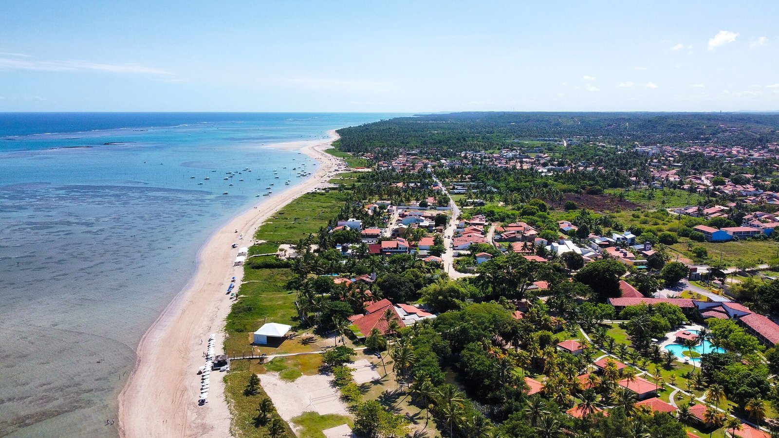
For most of the 20th century, Maragogi was a town of sugar mills, coconut groves and raft fishermen. Tourism started in the 1980s, as holidaymakers from nearby cities bought beach houses, and reached a new scale when the Salinas de Maragogi hotel opened in 1989. As the reef pools began appearing in magazines and on television, Maragogi was marketed as the “Brazilian Caribbean” and became a must-stop for visitors to Maceió and Recife. In 2024 it was the only town in Alagoas ranked in category A of the Brazilian Tourism Map, according to City Hall.
Maragogi today
The real town is bigger than its seafront. There is a center with shops, churches and a market, fishing villages such as São Bento and Barra Grande, and an interior of cane fields and Atlantic Forest. One of the best-known walks is the Visgueiro trail, about 6 km long, which leads to a giant tree around 500 years old and 22 meters tall, according to a report by g1 Alagoas. The calendar is full of religious and popular festivals: São Benedito in Peroba, Nossa Senhora da Guia in Barra Grande, São Bento in the village of the same name, the Mariscada seafood festival, the town’s Emancipation festival and, since 2021, the Festival de Velas sailing festival at the Pontal, promoted by the Alagoas State Tourism Department.
The Costa dos Corais protected area: why there are so many rules
Direct answer: the Costa dos Corais Environmental Protection Area (APA Costa dos Corais) is a federal protected area created on 23 October 1997, covering about 120 km of coastline between Alagoas and Pernambuco. It protects coral reefs, mangroves and the West Indian manatee. It is the reason Maragogi’s pools have boat limits, tide-based schedules and bans on fins and fish feeding.
The APA was created by federal decree in 1997 and is managed by ICMBio. In June 2025, Decree 12,490 expanded it by about 89,000 hectares, taking the total to more than 495,000 hectares. It spans 12 municipalities: nine in Alagoas (Maceió, Paripueira, Barra de Santo Antônio, Passo de Camaragibe, São Miguel dos Milagres, Porto de Pedras, Porto Calvo, Japaratinga and Maragogi) and three in Pernambuco (São José da Coroa Grande, Barreiros and Tamandaré). The current management plan was approved by Ordinance 308 of 19 July 2021.
The Costa dos Corais reefs form an almost continuous barrier parallel to the beach. At low tide, parts of them are exposed, creating shallow lagoons of clear, calm water full of fish: these are the natural pools. The ecosystem is fragile. Trampled or broken coral takes years to recover, and too many boats and people cloud the water, scare off the fish and damage the reef. ICMBio’s Public Use Plan recorded almost 300,000 trips to the APA’s pools in 2019, the great majority of them in Maragogi. Hence the controls.
The protected area has been through hard times too. In 2019, the oil spill that hit the northeastern coast reached the region’s beaches, and volunteers, fishermen and public agencies spent weeks cleaning up. The APA is also Brazil’s main protected area for the West Indian manatee: ICMBio runs a reintroduction program on the Tatuamunha River in Porto de Pedras, south of Maragogi.
What it means for you
In practice, the APA means three things. First, you can only visit the pools with an authorized operator and at a time set by the tide. Second, each pool has a maximum number of boats per day, and on holidays trips sell out. Third, there are rules in the water that your guide will repeat: don’t stand on the coral, don’t feed the fish, don’t use fins, and don’t take food or drinks into the water. Nobody is picking on tourists. The rules exist so that the pools stay the way you saw them in the photos.
Where to stay in Maragogi: town center, north coast or Japaratinga
Direct answer: stay in the town center if you want to walk everywhere and have restaurants and tour departures nearby. Choose the north coast (Barra Grande, Antunes, Ponta de Mangue) for quiet beaches and resorts, knowing you will depend on a car, taxi or transfer. São Bento and Japaratinga, to the south, have a village feel and smaller guesthouses.
Choosing where to stay in Maragogi is less about the hotel and more about the beach it sits on. The municipality has an urban seafront in the center and a long run of beaches to the north, along the AL-101 Norte highway, up to the Pernambuco border. To the south, past the Pontal and Camacho beach, comes São Bento and then, across the Salgado River bridge, Japaratinga. Distances look small on the map, but outside the center you can’t do everything on foot.
Town center and urban seafront
This is the most practical area. There are guesthouses and hotels at all price levels, restaurants, pharmacies, a supermarket and many of the departure points for the Galés. The sea in front of the center is calm and sheltered by the reefs. The downside is the bustle: in high season the seafront fills with cars, vendors and loud music. If you’re traveling without a car, it is still the best choice.
Burgalhau and Barra Grande
Just north of the center, Burgalhau beach is about 1 km away, by the mouth of the Rio dos Paus. Further on, about 8 km by road, is Barra Grande, a historic village that is the starting point for Moses’ Path and the pool of the same name. It is a good base if you want peace and quiet and easy access to the northern trips.
Antunes, Ponta de Mangue and Peroba
This is resort and boutique-guesthouse country. Antunes, just past Barra Grande, is a calm beach with shallow water and few facilities. Ponta de Mangue, about 8 km from the center as the crow flies, has tide pools close to the sand and some of the town’s biggest hotels. Peroba, about 10 km as the crow flies, is the last beach before Pernambuco. Staying here gets you empty beaches and silence, but you will need a car or transfer to have dinner in town.
São Bento and Camacho
To the south, Camacho beach sits at the mouth of the Maragogi River, and São Bento, about 6 km from the center by road, is a fishing village with a church, the monastery ruins and its famous stalls selling bolinho de goma, the local tapioca-starch biscuits. It works for travelers who want a village atmosphere at lower prices than the resorts.
Japaratinga and São Miguel dos Milagres
Japaratinga is about 11 km from central Maragogi, with equally calm water, guesthouses and an award-winning resort. São Miguel dos Milagres, about 35 km away, is the heart of the Ecological Route and has some of the most sought-after boutique guesthouses on the coast. If peace and quiet is your priority and you don’t mind driving to the Galés, both make good bases.
Weather and the best time to visit Maragogi
Direct answer: the best time to visit Maragogi is September to March, when it rains little, the sun is out almost every day and the water tends to be clearer. October, November and December are the driest months. April to July is the rainy season, with May, June and July each getting more than 270 mm of rain. But the season matters less than the tide: pick your dates by looking at the tide table.
Maragogi has a hot, humid tropical climate (As in the Köppen classification), with high temperatures all year and rain concentrated in autumn and winter (March to August in the Southern Hemisphere). The town has no INMET station with its own climate normals, so the table below uses the normals for the Maceió station, 125 km away, which has the same rainfall pattern as the northern Alagoas coast. Rainfall and maximum temperatures are from the 1991–2020 normals; minimums from the 1981–2010 normals.
| Month | Average low | Average high | Rain (mm) |
|---|---|---|---|
| January | 21.4 °C | 31.0 °C | 91.2 |
| February | 21.8 °C | 31.3 °C | 80.2 |
| March | 22.1 °C | 31.5 °C | 101.3 |
| April | 21.8 °C | 30.7 °C | 194.3 |
| May | 21.2 °C | 29.5 °C | 294.7 |
| June | 20.3 °C | 28.4 °C | 322.8 |
| July | 19.7 °C | 27.6 °C | 270.9 |
| August | 19.7 °C | 27.8 °C | 191.5 |
| September | 19.9 °C | 28.6 °C | 109.2 |
| October | 20.3 °C | 29.9 °C | 70.2 |
| November | 21.9 °C | 30.8 °C | 45.1 |
| December | 21.2 °C | 31.3 °C | 36.7 |
Source: INMET climate normals for the Maceió station. The figures are a reference for Maragogi, which has no normals of its own. A study by the Federal University of Campina Grande (UFCG) estimates about 1,400 mm of rain a year for the municipality, against about 1,800 mm in Maceió.
High and low season
High season runs from mid-December to Carnival, peaking at New Year’s and during the January school holidays, and returns in July, during the winter school break, despite the rain. On those dates hotel prices go up, pool trips sell out in advance and the town-center seafront gets crowded. September, October and November usually offer the best balance: settled weather, beautiful sea and fewer people outside public holidays. From April to June prices drop, but rain and wind can cloud the water on the very day of your trip.
The tide matters more than the calendar
In Maragogi, a sunny day with a 0.8 m low tide can be worse than a cloudy day with a 0.1 m low tide. The best low tides come around the full moon and the new moon, the so-called spring tides. Before you fix your dates, open the Brazilian Navy’s tide forecast for the Port of Maceió, the official reference used by ICMBio, and look for days when low tide is below 0.4 m and falls between mid-morning and mid-afternoon. If your trip is short, try to arrive a day before the best tide, so you have some slack if the weather turns.
What to pack
Light clothes, a hat, sunglasses, a UV shirt to wear in the water, neoprene or rubber water shoes for walking on sand and gravel, a snorkel mask and a dry bag for your phone. Bring a light rain jacket if you travel between April and August. Insect repellent helps in the late afternoon, near rivers and mangroves.
How to get to Maragogi
Direct answer: most people fly into Maceió or Recife and continue by car, transfer or day tour. Both airports are about 125 km and 2 hours away by road. From Maceió the route ends on the AL-101 Norte highway; from Recife it follows the BR-101 and PE-060, entering Alagoas over the bridge on the Persinunga River. Costa dos Corais Airport, in Maragogi, does not have commercial flights yet.
By air: Maceió or Recife?
Zumbi dos Palmares International Airport in Maceió (MCZ) is about 124 km from Maragogi, roughly 2 hours by car according to the OpenStreetMap router. Recife/Guararapes International Airport (REC) is practically the same distance, about 125 km, also around 2 hours. Recife usually has more direct flights, including international ones, and sometimes better fares; Maceió lets you combine the trip with the Alagoas capital and the beaches of the south coast. Compare both before you book.
What about Maragogi’s airport?
Costa dos Corais Airport is under construction in the municipality, with a 2,200-meter runway. The Alagoas state government had planned to start operations in 2026, but according to local press, in August 2026 the runway was still receiving its second layer of paving and the passenger terminal was still out to tender. In July, the state’s Partnerships Management Council selected studies for a future concession. As of October 2026 there were no commercial flights to Maragogi. Don’t buy a ticket there without official confirmation.
Driving from Maceió
From the Maceió seafront it is about 128 km; from the airport, about 124 km. The OpenStreetMap router takes you from the airport along state highways AL-405 and AL-105 to the AL-101 Norte, which reaches central Maragogi. The roads are two-lane, with curves, villages and speed bumps; allow 2 to 2.5 hours without stops and check GPS on the day, because roadworks and weekend traffic change the best route. Avoid driving at night on secondary roads, because of poor lighting and animals and cyclists on the road.
Driving from Recife
From Recife, take the BR-101 south and then the PE-060 toward Tamandaré and São José da Coroa Grande. After the state line, the road becomes the AL-101 Norte and passes Peroba and Ponta de Mangue before reaching the town center. It is the same route you’ll use to combine Maragogi with Porto de Galinhas (about 86 km) and Carneiros Beach (about 54 km).
Transfers, day tours and buses
Tour operators in Maceió, Recife and Porto de Galinhas sell both private transfers to your hotel and day trips. Luck Receptivo, for example, advertised in October 2026 a hotel-to-hotel transfer from Maceió to Maragogi or Japaratinga from R$290, and the same starting price for airport arrival or departure transfers. Day-trip prices vary with the season and the boat you choose: ask for the final price, including the environmental fee, before you pay. A day trip is tiring: about 4 hours on the road in one day, and the boat time depends on the tide. If you can, spend at least one night in Maragogi. There are also intercity buses regulated by ARSAL, the Alagoas regulatory agency, leaving from the João Paulo II bus terminal in Maceió for the north coast. Schedules change often: check at the terminal or with the bus company before relying on them.
Getting around Maragogi
Direct answer: in the town center you can walk or use motorbike taxis and regular taxis. To explore the northern beaches, São Bento, Japaratinga and the Milagres route, the most practical option is your own or a rental car, or buggy and van tours with local agencies.
By car
Having a car in Maragogi lets you follow the tide and switch beaches when the wind changes. The AL-101 Norte connects the center to Barra Grande, Antunes, Ponta de Mangue and Peroba, and the AL-101 Sul goes to São Bento and Japaratinga. To reach São Miguel dos Milagres and Porto de Pedras along the coast, you’ll cross the Manguaba River by ferry (balsa), between Japaratinga and Porto de Pedras. In the center, park only where allowed and don’t leave anything visible in the car. Some beaches have paid private parking.
Taxis, motorbike taxis and ride apps
There are taxis and motorbike taxis (mototáxis) in the center, and ride-hailing apps work patchily, with few cars outside high season. To get back from a remote beach in the late afternoon, agree on a pickup time with the driver on the way out and keep their phone number.
Buggies and van tours
Buggy tours are the classic way to see the beaches without driving. Luck Receptivo advertises, in 2026, a private buggy along Maragogi’s north coast from R$300 and along the south coast from R$350, per buggy. Local agencies also sell van trips to Milagres, Patacho, Carneiros and Porto de Galinhas. Check that the buggy driver is licensed and that the price includes fees.
Tides, rules and fees: what to know before visiting the pools
Direct answer: Maragogi’s natural pools only open around low tide, from 2 hours before to 2 hours after the low tide forecast by the Brazilian Navy for the Port of Maceió. Each boat makes one trip a day, there is a daily cap on boats at each pool, and in the water fins, food, drinks and standing on coral are all banned. The federal government charges no fee, but City Hall charges a municipal environmental fee of R$7 per person.
How to read the tide table
The Brazilian Navy publishes tide forecasts for each port, with the times and heights of every high and low tide. For Maragogi, use the Port of Maceió forecast, which is the one ICMBio’s rules guide adopts. The number that matters is the height of low tide, in meters. The lower, the better: below 0.3 m the reef is well exposed and the water in the pools is shallow and still. Sources do not agree on a single cut-off. The 2013 management plan banned visits to the pools when the tide was 0.7 m or higher, and local news reports mention trips running on tides of up to about 0.6 m. In practice, the closer to zero, the better: if you can choose, go for days when low tide is no higher than 0.3 or 0.4 m.
Limits on boats and people
ICMBio’s rules guide for Maragogi sets the maximum number of boats per day at each pool. At the Galés: 10 catamarans, 10 schooners and 8 speedboats. At Taocas: 4 catamarans, 4 schooners and 6 speedboats. At Barra Grande: 6 catamarans, 6 schooners and 9 speedboats. Each catamaran carries up to 54 visitors, each schooner up to 12 and each speedboat up to 8. At the smaller pools, such as Ponta de Mangue and Barretinha, access is by jangada raft or speedboat, with up to 6 visitors per boat. Each boat may make only one trip a day, so on a good-tide day in high season places run out early.
What is banned in the pools
Under ICMBio’s rules, inside the pools you may not stand on coral, feed the fish, collect shells, coral or any other living thing, use fins, kayaks or stand-up paddleboards, or eat and drink in the water (food stays on the boat, and alcohol is not allowed). Scuba diving is only authorized at the Galés, Taocas and Barra Grande, with an accredited operator. Boats must not exceed 5 knots inside the visiting areas. We found no official rule on sunscreen, but to reduce the impact on the coral, wear a UV shirt and apply sunscreen well before getting in the sea.
Environmental fee and minimum price
ICMBio states that there is no federal visitor fee in the APA. Maragogi City Hall charges a municipal environmental fee per person on boat trips: it was R$3 in the December 2024 ordinances and rose to R$7 from 24 February 2025 under Ordinance 352/2025, according to the Maragogi News website. It is usually included in the trip price, but ask. City Hall also sets a minimum price for pool trips: in December 2024 it was R$120 per person by jangada raft (Ordinance 360/2024), R$120 by schooner (Ordinance 361/2024) and R$150 by speedboat (Ordinance 362/2024). That is a floor, not a ceiling, and it is reviewed every year. We found no price ordinance for catamarans, which are sold by agencies.
Jet skis: banned
Since January 2026, Maragogi City Hall has been enforcing the ban on commercial jet ski rides along the shore, set out in Municipal Decree 057/2021 and reinforced by a recommendation from the Alagoas Public Prosecutor’s Office. According to Gazetaweb and Cada Minuto, offenders have their equipment seized and pay a daily fine of R$5,000. If anyone offers you a jet ski ride to the pools, say no.
Things to do in Maragogi: natural pools, beaches and day trips
Direct answer: the essentials are a trip to the natural pools (Galés, Taocas or Barra Grande), Moses’ Path on the lowest tide, a day on a calm beach on the north coast, a visit to São Bento with its sandbank and monastery ruins, and day trips to the Milagres Ecological Route, with the manatees, and to Carneiros Beach. Scuba diving, buggy rides and the Visgueiro trail round out the list.
Maragogi has three kinds of outing: boat trips to the offshore reefs, tide walks on the beaches (crossing sandbars, swimming in the pools between corals close to shore) and road trips to the neighboring beaches. Almost everything depends on the tide table, so the trick is to plan backwards: first find the days and times with the best low tides, then fit everything else around them.
Galés: the most famous natural pool
The Galés are Maragogi’s postcard. They lie in open sea, about 4 to 5 km from the coast according to a City Hall document, and only appear when low tide exposes the reef. The boat anchors at an authorized spot, you climb down with mask and snorkel and float between channels of white sand, coral heads and schools of small fish that come close to anyone who stays still. How long you stay depends on the tide and the operator. On the best days the water is so clear you can see the bottom several meters down. It is also the busiest pool: ICMBio’s rules guide allows 10 catamarans, 10 schooners and 8 speedboats a day, and total capacity is just over 700 people. On public holidays, book several days ahead.
The catamaran trip is the most common and the cheapest per person, but it takes a lot of people at once. Speedboats and schooners carry smaller groups and get there faster, which makes a difference on a choppy day. Before paying, confirm three things: which pool the boat is going to that day (operators rotate between pools), the departure time and whether the municipal environmental fee is included. The skipper should carry an ICMBio badge and authorization, and the boat should have an authorization seal.
Taocas and Barra Grande: the calmer alternatives
Taocas lies between the Barra Grande pool to the north and the Galés to the south. The 2013 management plan mentions a reef called Pedra do Meio between Taocas and the Galés. The rules are the same as at the Galés, but the boat cap is much lower, at 4 catamarans and 4 schooners a day, and the 2013 plan set a limit of 426 visitors a day. In practice it tends to be less crowded.
The Barra Grande pool lies further north, off the village of the same name, with a visiting area of about 2.7 km in perimeter marked out by ICMBio. It is convenient if you are staying in northern Maragogi, and Barra Grande beach is an official boarding point. Don’t mix them up: the Barra Grande pool is an offshore reef visited by boat. Moses’ Path is a sandbar you walk out on from the beach. They are different outings, and they rarely fit into the same low-tide window.
Ponta de Mangue and Barretinha: raft pools
The north of the municipality has smaller pools closer to shore, such as Ponta de Mangue (divided into north, middle and south) and Barretinha (north and south). Access is by jangada raft or small speedboat, with up to 6 visitors per boat, and the rules guide sets between 12 and 21 boats a day at each. The trip is shorter and feels more artisanal, run by local raft fishermen. It is a good option for small children and for anyone who gets seasick on big boats.
Moses’ Path (Caminho de Moisés)
Moses’ Path is a bank of sand, gravel and shell fragments running perpendicular to Barra Grande beach. It is always there, but it only surfaces when the tide drops very low. According to a Tribuna Hoje report, that happens with tides between −0.1 and 0.2 m, on four or five days a month, and the walk reaches about 800 meters out to a rock formation. The newspaper O Povo, in 2026, spoke of a strip of up to 2 to 3 km. There is no official measurement. The name recalls the biblical parting of the sea, but what happens is simpler: the water gets shallow enough to reveal the seabed.
It is a walk and needs no boat. Get to the beach about an hour before the low-tide peak, walk unhurriedly and start heading back just after the peak. The water returns first in the stretch nearest the beach, so don’t wait for the path to close behind you. Bring water, a hat and water shoes: there is no shade on the sandbar. The site is also being watched by the Alagoas Public Prosecutor’s Office. In March 2026 it opened proceedings to monitor compliance with Recommendation 003/2026, which asks City Hall to remove the beach stalls set up irregularly on Moses’ Path and to ban new ones, and in May the Maragogi News website reported that structures had reappeared. Follow the inspectors’ instructions and don’t buy services from anyone setting up on the sandbar.
Maragogi town beach
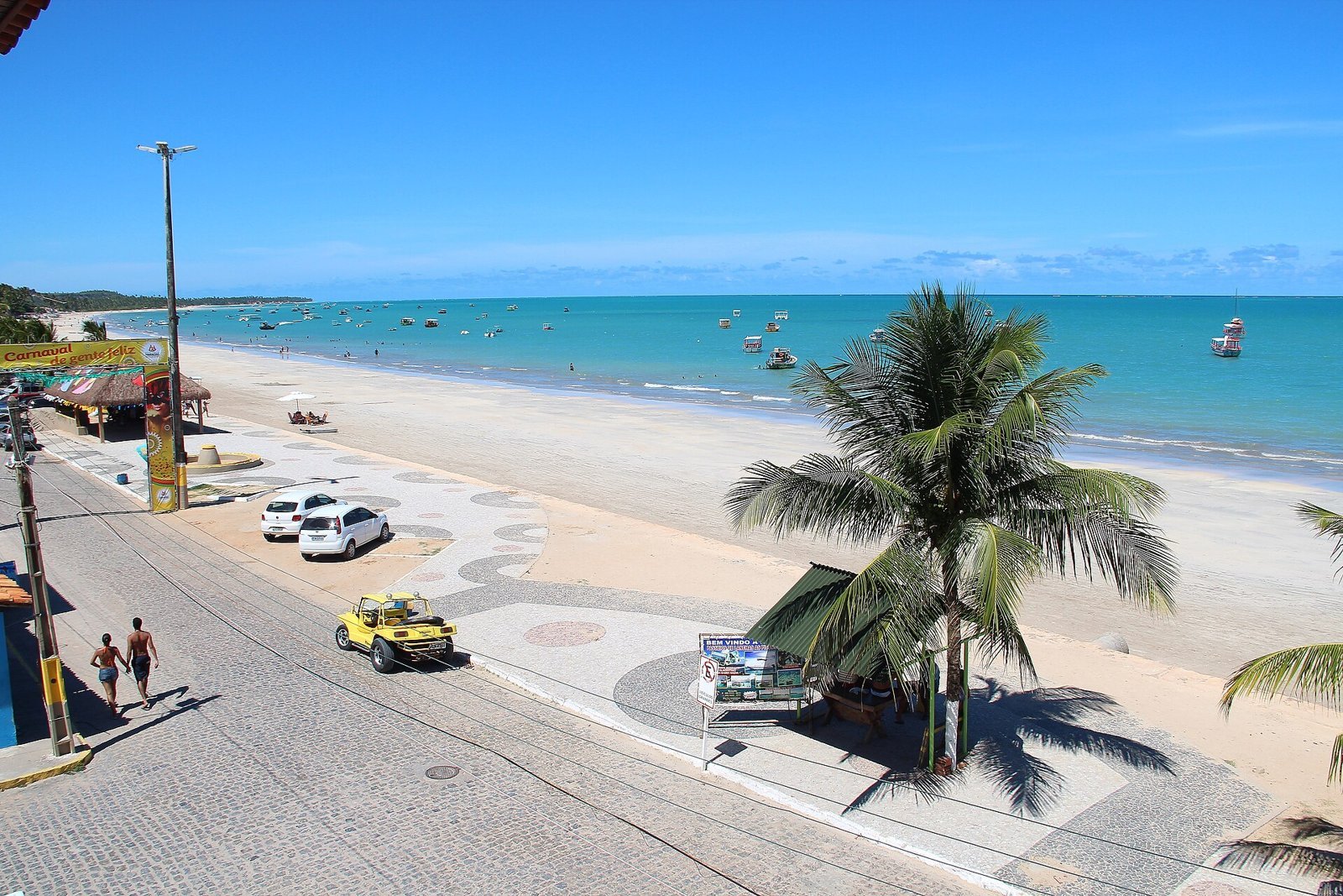
The town-center seafront is the busiest beach, with the most facilities: bars, restaurants, guesthouses and shops facing the sea. The water is calm, sheltered by the reef barrier, and at low tide parts of the reef appear close to the sand. Next to it is the Pontal, where the Maragogi River meets the sea, with palm trees and a sandbar that changes shape with the tide. That is where the Festival de Velas sailing festival is held. In the late afternoon, the seafront is the best place to see the town come alive.
Burgalhau, Barra Grande and Xaréu
Heading north on the AL-101, the sequence of beaches listed by the Association of Alagoas Municipalities is Burgalhau, Barra Grande, Xaréu, Antunes, Dourado, Ponta de Mangue and Peroba. Burgalhau starts just past the Rio dos Paus, about 1 km from the center, with calm water and mostly local beachgoers. Barra Grande is an old village, a district of Maragogi since 1911, with a church, fishing boats and the Moses’ Path beach. Tribuna Hoje reports free parking on nearby streets, but watch the signs.
Antunes, Ponta de Mangue and Peroba: the quiet north
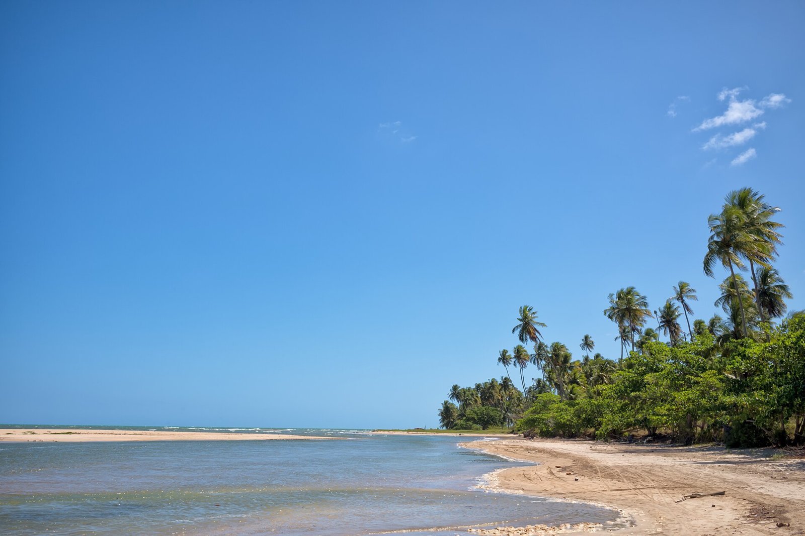
Antunes is the beach many people picture when they imagine Maragogi without the crowds: pale sand, palm trees and shallow water sheltered by the reefs. At low tide, pools form between the corals where you can see small fish without leaving the sand. Ponta de Mangue, near the Pernambuco border, has the same profile, with more hotels and the raft pools offshore. Peroba is the last beach before Pernambuco: family-friendly, quiet on weekdays and with few businesses. To see all three, go by car or buggy and choose a low-tide morning.
São Bento: sandbank, monastery and biscuits
São Bento is Maragogi’s southernmost village, with a fishermen’s beachfront and boats pulled up on the sand. Three reasons to go: the croa (sandbank) of São Bento, a bank of coral and sand about 2 km offshore, visited in small boats only on tides of up to 0.6 m, on a trip of about two hours, according to Tribuna Hoje; the ruins of the 17th-century monastery, which served as a stopover for clergy riding between Olinda and Porto Calvo and were restored in 2020; and the sequilhos, crumbly tapioca-starch biscuits made with coconut milk, egg yolk and sugar and sold from homes in the village. Luck Receptivo advertised the Crôa de São Bento trip from R$140 in October 2026.
Japaratinga and its pools
Japaratinga is about 11 km from central Maragogi, some 15 minutes by car on the AL-101. Its main beach is calm, with wide sand, and it is the departure point for the municipality’s pools, such as Prainha and the Piscina do Picão, about 2 km from the beach according to Tribuna Hoje. ICMBio says Japaratinga takes part in managing the pools and charges a municipal fee: check the amount with the local city hall.
The Milagres Ecological Route and the manatees
The Milagres Ecological Route (Rota Ecológica dos Milagres) is the stretch of road and beaches between Porto de Pedras, São Miguel dos Milagres and Passo de Camaragibe, south of Maragogi. It is not a park and has no entrance fee: you drive along it and stop wherever you like. From Maragogi, head south on the AL-101 to Japaratinga and take the ferry across the Manguaba River to Porto de Pedras (about 21 km and 35 minutes, not counting the wait). Central São Miguel dos Milagres is about 36 km away. The most popular beaches are Patacho, Lajes and Tatuamunha, in Porto de Pedras, and Toque, Porto da Rua and central Milagres, where sailing rafts take visitors to the natural pools. The Toque pool is about 1 km from the beach, according to Tribuna Hoje.
The highlight is the manatee-watching trip on the Tatuamunha River, in Porto de Pedras, run by a residents’ association. According to the APA management plan, it is the only place in the protected area where manatee-watching tourism is allowed. In October 2026 the association listed a price of R$100 per person (children under 3 go free). Nobody touches, feeds or chases the animals, and watching each manatee is limited to 15 minutes.
Carneiros Beach (Pernambuco)
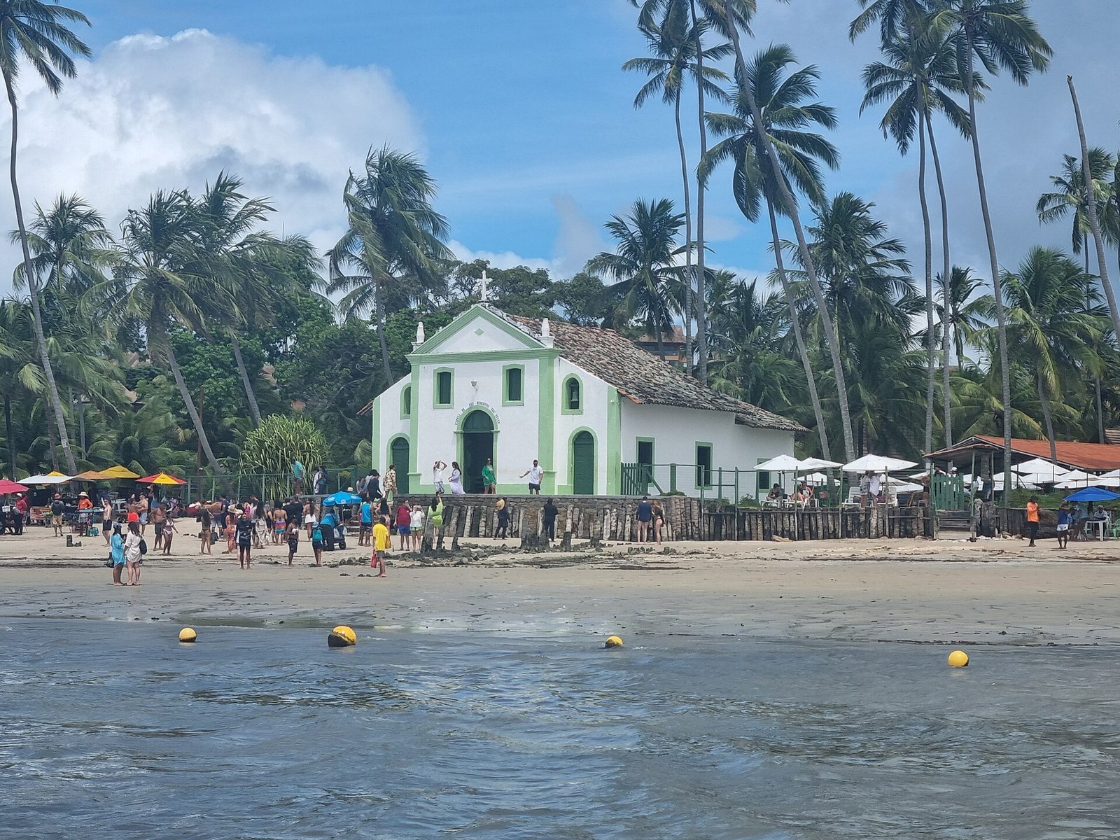
Carneiros Beach is in Tamandaré, Pernambuco, about 54 km north of Maragogi, a little over an hour by car. It is one of the most photographed beaches in the Northeast, with tall coconut palms, calm water shaped by the mouth of the Formoso River and the reef barrier, and the small 18th-century Chapel of São Benedito almost at the water’s edge. Road access goes through private properties, where restaurants charge a minimum spend. You can also arrive by boat or walk about 7 km along the sand from Tamandaré beach. It is a good day trip for when Maragogi’s tide isn’t cooperating.
Scuba diving
Maragogi is a good place for a first dive. Discover-scuba dives, with a tank and an instructor, are only allowed at the Galés, Taocas and Barra Grande pools under ICMBio’s rules guide, and must be done with an authorized operator. The 2013 management plan requires at least one divemaster for every two uncertified divers. Tell the operator about any health issues and ask about the safe interval between diving and your flight home.
Buggies, the Visgueiro trail and river trips
Buggy rides are the traditional way to see the beaches without driving, and tours are usually split into north coast and south coast. If you want a break from the beach, the Visgueiro trail, about 6 km long, leads through Atlantic Forest to a tree about 500 years old and 22 meters tall, according to g1 Alagoas. Hire a local guide and go in the morning, because of the heat.
Where to eat in Maragogi
Direct answer: eat fresh fish, shrimp, caldinhos (small cups of thick broth) and dishes made with sururu, the mussel from the Alagoas lagoons that has been declared part of the state’s intangible heritage. The town center and urban seafront have the widest choice of restaurants. On the northern beaches there are fewer options, many of them tied to hotels. In São Bento, try the sequilhos, the local tapioca-starch biscuits.
Food in Maragogi follows the cooking of the Alagoas coast: fish and seafood, coconut, cassava and tapioca. The typical beach-day lunch is fried or grilled fish, whole or in steaks, with rice, beans, salad, farofa (toasted cassava flour) and boiled cassava, served for two. Fish in coconut milk and moqueca stew appear on almost every menu, as do shrimp in many forms and caldinhos of bean, fish, shrimp or sururu, served in a cup.
Sururu, the symbol of Alagoas
Sururu is a small mussel typical of the Alagoas lagoons and tied to the lives of the communities that fish them. In December 2014, the State Culture Council unanimously approved its registration as Intangible Heritage of Alagoas. In Maragogi you’ll find it as a broth, cooked in coconut milk or in a moqueca. If you only try one local dish, make it this one.
Tips to eat well and spend less
Ask the price of fish per kilo before you order, because that is where bills surprise people most. Sharing dishes usually feed two comfortably. Go for the catch of the day and ask what is fresh: some species have a closed season, when fishing is banned. Minimum spends at beach shacks and tied sales go against Brazil’s Consumer Protection Code, but they are common on beaches reached through private property, such as Carneiros: ask about the rules before sitting down. If you are allergic to seafood, say so when ordering, because many sauces and broths contain shrimp. For snacks, there are tapioca pancakes, cuscuz (steamed corn cake) and regional fruit in the center.
By area
The center has regional cooking, pizzerias, snack bars and simpler options, all a few steps from the seafront. On the northern beaches (Antunes, Ponta de Mangue, Peroba) there are fewer restaurants and they are farther apart, so check whether your hotel includes dinner. Pool trips do not serve meals in the water: food and non-alcoholic drinks only on board, under ICMBio rules. City Hall organizes food events such as the Mariscada seafood festival, with dates that change every year. For more on the country’s cooking, see our Brazilian food guide.
How much a trip to Maragogi costs
Direct answer: beyond flights and accommodation, the main costs are the transfer (from R$290 each way with an agency), the pool trip (municipal minimum price of R$120 to R$150 per person) plus the R$7 environmental fee, a buggy (from R$300 per buggy) and the manatee trip (R$100 per person). Accommodation varies widely between a simple guesthouse and an all-inclusive resort.
The prices below come from official sources or sales pages checked in October 2026. They are reference prices, not guarantees. Restaurant and hotel prices are not included because they change with the date and have no official source.
| Item | Reference price | Source |
|---|---|---|
| Jangada raft trip to the pools | from R$120 per person (minimum price) | City Hall, Ordinance 360/2024 |
| Schooner trip to the pools | from R$120 per person (minimum price) | City Hall, Ordinance 361/2024 |
| Speedboat trip to the pools | from R$150 per person (minimum price) | City Hall, Ordinance 362/2024 |
| Municipal environmental fee | R$7 per person | Ordinance 352/2025, via Maragogi News |
| ICMBio federal fee | none | ICMBio |
| Transfer Maceió–Maragogi or Japaratinga | from R$290 | Luck Receptivo, Oct 2026 |
| Private buggy, north coast | from R$300 per buggy | Luck Receptivo, Oct 2026 |
| Private buggy, south coast | from R$350 per buggy | Luck Receptivo, Oct 2026 |
| Crôa de São Bento | from R$140 | Luck Receptivo, Oct 2026 |
| Manatee trip (Porto de Pedras) | R$100 per person; under-3s free | Local association, Oct 2026 |
| Day trip to Patacho Beach or São Miguel dos Milagres | from R$110 | Luck Receptivo, Oct 2026 |
To save money, travel outside December, January and July, share a transfer or rent a car as a group, book the pool trip directly with an authorized operator and have lunch in the center, away from the most touristy beach shacks. The municipal minimum prices are reviewed every year, with September as the base month, according to the ordinances. For general advice on money, safety and getting around, see our Brazil travel tips and transport guide.
Maragogi itinerary: 2, 3 or 4 days
Direct answer: in two days, do the Galés on the morning with the best tide and use the other day for Moses’ Path or the northern beaches. With three days, add the Milagres Ecological Route and the manatees. With four, include Carneiros or São Bento and Japaratinga. Plan around the tide table, not the day of the week.
Maragogi in 2 days
- Day 1: arrive in the morning from Maceió or Recife. In the afternoon, the town beach and the Pontal, with sunset on the seafront. Book the pool trip for the next day, confirming the time and fee.
- Day 2: trip to the Galés (or Taocas, or Barra Grande) at low tide. Fish lunch in the center. If the day’s low tide is very low, fit in Moses’ Path at Barra Grande; if not, spend the afternoon at Antunes.
Maragogi in 3 days
- Day 1: arrival, town center, Pontal and seafront.
- Day 2: natural pools in the morning and the northern beaches in the afternoon (Barra Grande, Antunes, Ponta de Mangue).
- Day 3: the Milagres Ecological Route. Leave early, take the ferry to Porto de Pedras, do the manatee trip on the Tatuamunha River (book ahead) and spend the afternoon at Patacho or on the raft pools of São Miguel dos Milagres.
Maragogi in 4 days
- Days 1 to 3: as above.
- Day 4: choose between Carneiros Beach in Tamandaré (about an hour north) or a slower day in São Bento and Japaratinga, with the sandbank, the monastery ruins, the sequilhos and Japaratinga’s main beach. Divers can swap this day for a discover-scuba dive at the Galés.
Itinerary tips
If your trip coincides with low tides above 0.5 m, flip the plan: do the road trips (Milagres, Carneiros) on those days and save the pools for when the tide improves. Never leave the boat trip for your last day with no slack, because rain and wind can cancel departures. And if you are flying home the same day, leave Maragogi at least four hours before your flight. Want to keep going along the coast? Our Northeast Brazil coast road trip links Maragogi to the other big beach destinations.
Is Maragogi safe?
Direct answer: Maragogi is a peaceful destination for most visitors. The most common problems are sunburn, reef cuts, dehydration and scares in the sea. Wear water shoes and a UV shirt, drink water, respect the tide and the lifeguards’ flags, and don’t leave valuables visible in the car or on the sand.
In the sea and on the reefs
The sea near the sand is usually calm where there is a reef barrier, but that changes with the tide and the wind. A red flag means swimming is not advised; yellow means take care. If a current pulls you, don’t swim against it: swim parallel to the beach until you are out of it and wave for help. On reef beaches the water comes back fast on a rising tide, so don’t walk far from the sand without knowing the tide times. In the pools, wear the life jacket the boat offers if you are not a strong swimmer, and stay close to the group.
Sun and heat
The average January high is above 31 °C, and reflection off the water increases exposure. Rely on clothing for sun protection before going onto the reef, and reapply sunscreen when you come out. Signs of heatstroke are headache, dizziness, nausea and very hot skin: find shade, drink water and, if it doesn’t improve, call 192.
In town and on the road
In busy places, watch your bag and phone as you would in any tourist destination. Don’t leave anything visible in the car. Avoid driving at night on secondary roads and on the AL-101, because of poor lighting, cyclists and animals. Book trips only with authorized operators, with badges and identified boats, and be wary of offers far below the municipal minimum price.
Useful numbers
- Military Police: 190, for crime, threats or safety risks.
- SAMU ambulance: 192, for medical emergencies.
- Fire Department: 193, for drowning, sea rescue and fires.
- Tide forecast: Brazilian Navy, Port of Maceió.
Calls to 190, 192 and 193 are free and work from any mobile phone. Operators usually speak only Portuguese, so keep your hotel’s phone number handy.
Places to visit near Maragogi
Direct answer: Maragogi sits in the middle of the Costa dos Corais and pairs well with Japaratinga (11 km), Porto de Pedras and the Milagres route (21 to 36 km), Carneiros Beach (54 km), Porto de Galinhas (86 km), and Maceió and Recife, each about 125 km away.
- Maceió: the Alagoas capital has the Pajuçara and Ponta Verde seafront, raft trips to natural pools and the beaches of the south coast. See our Maceió travel guide.
- Porto de Galinhas: about 86 km away, with raft trips to natural pools and nightlife. Read our Porto de Galinhas travel guide and the guide to Porto de Galinhas natural pools and tides.
- Recife: the Pernambuco capital has a historic center, Olinda next door and the region’s busiest airport. See our Recife travel guide.
- Japaratinga and São Miguel dos Milagres: quiet villages to the south, with raft pools and the manatees, covered in the sections above.
- Natal, Fortaleza and Salvador: to extend your trip through the Northeast, see our guides to Natal, Fortaleza and Salvador.
- Fernando de Noronha: the archipelago is reached from Recife and is the next step for anyone who falls for the reefs. Read our Fernando de Noronha travel guide, and for more ideas, our list of the best beaches in Brazil.
Where to stay in Maragogi: 10 hotels with official websites
Direct answer: for an all-inclusive resort, look at Salinas Maragogi, Grand Oca Maragogi, Praia Dourada Resort and, in Japaratinga, Japaratinga Lounge Resort. To stay in the center, within walking distance of restaurants and boat departures, try Hotel Areias Belas, ibis Styles Maragogi and Pousada Agua de Fuego. For peace and quiet, Pousada Vila Sagui on Camacho beach, Villa Pantai Boutique Hotel in São Bento and Bitingui Praia Hotel in Japaratinga. The links go to each property’s official website and were checked on 28 October 2026. There are no affiliate links. The facilities mentioned are those listed on each website, and the photos in this guide are not of the hotels.
One tip before you book: ask which beach the hotel is on and how far it is from the boarding point for the pool trips. In Maragogi, location matters more than star rating. Resorts on the north coast and in Japaratinga often offer transfers to the trips, but check whether there is a charge.
Salinas Maragogi All Inclusive Resort (all-inclusive resort, Maragogi)
Salinas Maragogi All Inclusive Resort is on the AL-101 Norte highway, km 124, according to its official website, which presents it as a beachfront family resort with kids’ facilities, a spa and an all-inclusive plan. Opened in 1989, it marked Maragogi’s tourism turn, according to Wikipedia. In October 2026, the website advertised double-room rates from R$2,849 per night for November. Listed phone: +55 82 3296-3000.
Grand Oca Maragogi Beach & Leisure Resort (resort, Ponta de Mangue)
Grand Oca Maragogi Beach & Leisure Resort is on the AL-101 Norte highway at Ponta de Mangue, 10 meters from the beach, according to its official website. The resort lists 420 units in standard, bungalow, suite and deluxe categories, several pools spread over almost 400 meters and a baby area. Listed phones: +55 82 2126-8224 and +55 82 3296-3200.
Praia Dourada Resort Maragogi (resort, north coast)
Praia Dourada Resort Maragogi is on the AL-101 Norte highway, km 130, according to its official website, which describes it as a beachfront resort for family holidays, with a restaurant serving northeastern Brazilian food and the Douradinho Kids children’s area. Listed phone: +55 81 3424-4545.
Hotel Areias Belas (hotel, town center)
Hotel Areias Belas is at Avenida Beira Mar, 59, in the center, according to its official website, which highlights its location facing the natural pools on the town seafront, with rooms with balconies and sea views. It is a good base if you don’t have a car. Listed phones: +55 81 99108-0101 and +55 82 99352-7635.
ibis Styles Maragogi (hotel, seafront)
ibis Styles Maragogi is at Rodovia AL-101, 993, according to its official website, which presents it as Brazil’s first beachfront ibis Styles, with sea-facing rooms, a heated pool, a kids’ area and a 24-hour gym. The hotel says it accepts pets and sells day passes. Listed phone: +55 82 2180-0272.
Pousada Agua de Fuego (guesthouse, Maragogi beach)
Pousada Agua de Fuego is on Maragogi beach and lists 17 rooms, some on the ground floor and some on the first floor, each with its own balcony and hammock, according to its official website. Rooms range from single to quadruple, with air conditioning. It is a mid-priced option close to the seafront. Listed phones: +55 82 98847-4573, +55 82 98762-0272 and +55 82 98892-1327.
Pousada Vila Sagui (guesthouse, Camacho beach)
Pousada Vila Sagui is on the AL-101 Norte highway, km 123, on Camacho beach, south of the center, according to its official website. It is a small guesthouse with beach access, for travelers who want quiet while staying a few minutes’ drive from the center.
Villa Pantai Boutique Hotel (boutique hotel, São Bento)
Villa Pantai Boutique Hotel is at Rua Maria Uchoa de Melo, 106, in the village of São Bento, according to its official website, which highlights suites with private pools and sea views, bungalows, a pool with deck and a restaurant. It is the pick for a trip for two. Listed phone: +55 82 99425-8099.
Japaratinga Lounge Resort (all-inclusive resort, Japaratinga)
Japaratinga Lounge Resort is at AL-101 Norte, km 128, no. 33C, in Japaratinga, facing the beach, according to its official website, which sells a premium all-inclusive plan and has a spa. It is about 15 minutes from central Maragogi. Listed phone: +55 82 3021-8585.
Bitingui Praia Hotel (hotel, Japaratinga)
Bitingui Praia Hotel is at Sítio Bitingui, 300, in Japaratinga, according to its official website, which lists free Wi-Fi, breakfast and parking. It is close to the Barreiras do Boqueirão cliffs and is a simpler, quieter option south of Maragogi. Listed phone: +55 82 3297-1500.
Video: Maragogi
The short video below was published by Visite Alagoas, the Alagoas tourism portal run by the state hotel association (ABIH-AL), and shows Maragogi’s beaches and the Costa dos Corais. It gives a quick feel for the color of the water and the coastline before you plan your tide days.
Maragogi FAQ
What is there to do in Maragogi?
The main things to do are a boat trip to the natural pools of the Galés, Taocas or Barra Grande, Moses’ Path on a very low tide, the calm northern beaches (Antunes, Ponta de Mangue, Peroba), São Bento with its sandbank and monastery ruins, and day trips to the Milagres Ecological Route, with the manatee trip, and to Carneiros Beach.
How many days do you need in Maragogi?
Two days are enough for the pools and the town’s beaches. With three you can add the Milagres route; with four, Carneiros or Japaratinga. Always keep a spare day in case the boat trip is canceled because of rain or a poor tide.
When is the best time to visit Maragogi?
September to March, when it rains less. October, November and December are the driest months, according to INMET normals for Maceió. April to July is wetter, with June above 300 mm. More important than the month is choosing days with low tide close to zero, around the full or new moon.
How do the tides work at Maragogi’s natural pools?
Trips run from 2 hours before to 2 hours after the low tide forecast by the Brazilian Navy for the Port of Maceió, as ICMBio requires. The lower the tide, the better the pool. The 2013 management plan banned visits when the tide was 0.7 m or higher.
How much does the Galés trip cost?
City Hall sets a minimum price per person: R$120 by jangada raft or schooner and R$150 by speedboat, under the December 2024 ordinances, which are reviewed every year. There is also a municipal environmental fee of R$7 per person. Catamarans have no price ordinance and are sold by agencies.
Is there a fee to visit the natural pools?
ICMBio charges no federal fee in the Costa dos Corais protected area. Maragogi City Hall has charged a municipal environmental fee of R$7 per person on boat trips since February 2025, according to Maragogi News. It is usually included in the trip price, but check.
What is Moses’ Path in Maragogi?
It is a bank of sand and gravel off Barra Grande beach, in northern Maragogi, that only appears on the lowest tides, between −0.1 and 0.2 m according to Tribuna Hoje, on four or five days a month. You walk out to sea on foot, with no boat. Head back just after the low-tide peak.
How do you get to Maragogi from Maceió or Recife?
By car, transfer or day tour. Maceió Airport is about 124 km away and Recife Airport about 125 km, both around 2 hours by road. Agencies sell transfers from R$290. Maragogi’s own airport still had no commercial flights in October 2026.
Can you ride a jet ski in Maragogi?
Not commercially. Municipal Decree 057/2021 bans commercial jet ski use along the whole shoreline, and since January 2026 City Hall has been enforcing it with equipment seizure and a daily fine of R$5,000, following a recommendation from the Alagoas Public Prosecutor’s Office.
Is Maragogi good for kids?
Yes. The sea is calm thanks to the reef barrier, and the raft pools at Ponta de Mangue and Barretinha are shorter trips. Use water shoes and a life jacket, choose a morning low tide and avoid the strong sun between 10 am and 3 pm.
Is Maragogi worth visiting?
Yes, as long as you plan around the tide. Arrive on a day with a 0.1 m low tide, slip into the Galés with the water perfectly still and you’ll understand the town’s fame immediately. Arrive with a 0.8 m tide, rain and wind and it can all seem ordinary. So the rule of this Maragogi travel guide is simple: open the Brazilian Navy’s tide table before you buy your ticket, spend at least two nights in Maragogi and use the poor-tide days for the Milagres route and Carneiros. And remember you are in a protected area: ICMBio’s rules, the boat limits and the environmental fee are what keep the reef alive for the next visit. To keep traveling along the coast, see our Maceió travel guide and Porto de Galinhas travel guide.
Sources
- ICMBio: Costa dos Corais APA (Portuguese)
- ICMBio: rules guide for Maragogi’s pools (PDF, Portuguese)
- ICMBio: Costa dos Corais Public Use Plan (PDF, Portuguese)
- Planalto: Decree 12,490/2025 (APA expansion)
- Maragogi City Hall: category A on the Brazilian Tourism Map
- Maragogi News: environmental fee increase
- Gazetaweb: jet ski ban in Maragogi
- Cada Minuto: Prosecutor’s Office and Moses’ Path
- Extra Alagoas: status of Maragogi airport
- Brazilian Navy: 2026 tide tables (CHM, Portuguese)
- INMET: climate normals
- Wikipedia: Maragogi
- Luck Receptivo: Maragogi tours (reference prices)
- OpenStreetMap and OSRM: driving distances and times