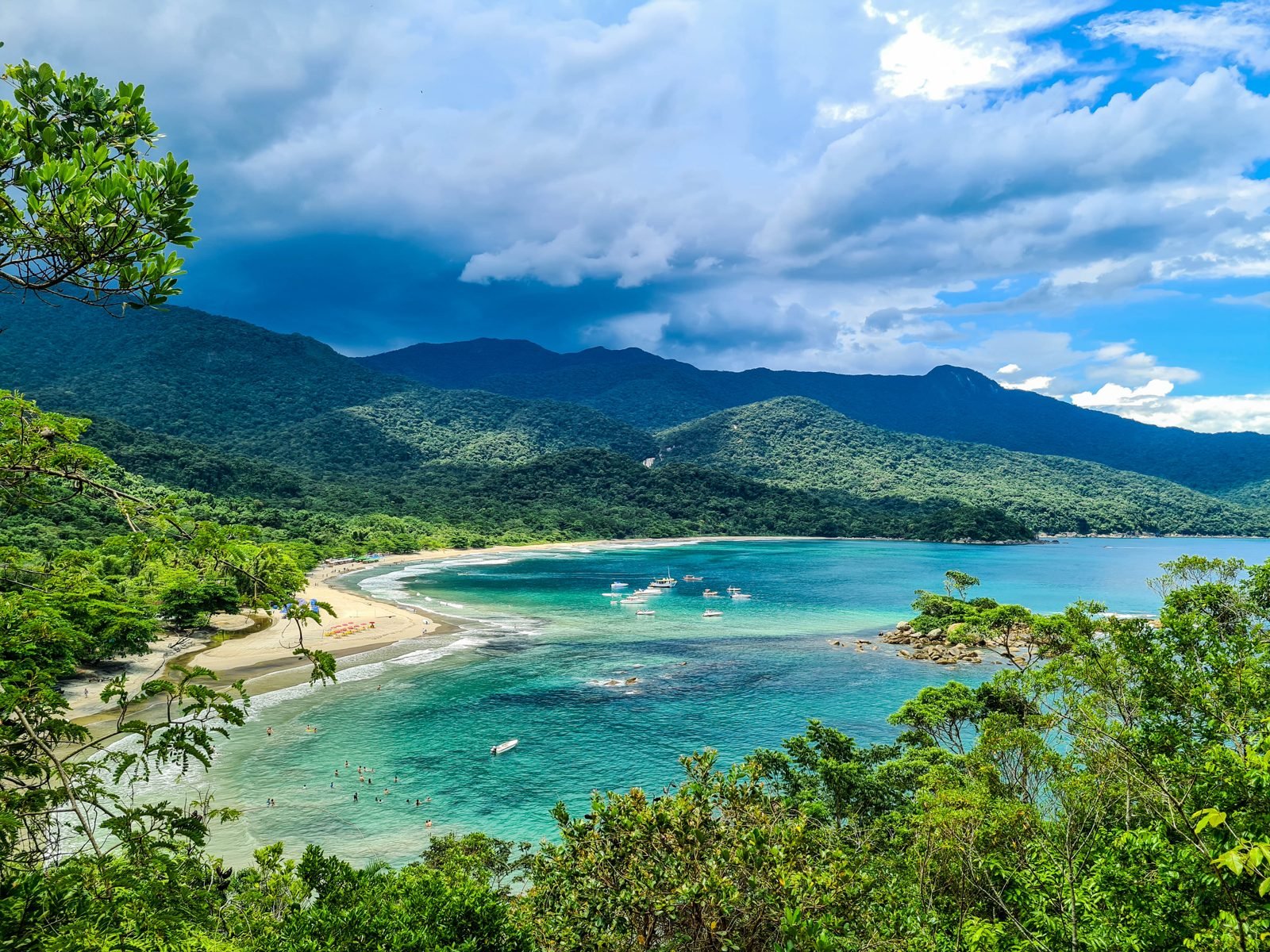
Ilhabela is an archipelago on the north coast of São Paulo state, in southeastern Brazil, separated from the mainland by a channel just under a kilometer wide, facing the town of São Sebastião. The main island, Ilha de São Sebastião, is the second-largest sea island in Brazil, and about 85% of the municipality lies inside Ilhabela State Park. This Ilhabela Brazil travel guide comes down to a few essentials: stroll the historic center, known as the Vila, swim at the calm beaches on the channel side such as Curral, Feiticeira and Julião, ride a 4×4 or a boat to Castelhanos Bay, hike to the fishing village of Bonete, cool off in the waterfalls, dive the shipwrecks and the Ilha das Cabras marine sanctuary, and watch the sun set behind the Serra do Mar mountains across the channel.
We put this guide together in October 2026 and checked the facts against official sources: Ilhabela City Hall (ferry, environmental fee, weather, trails and the control program for the borrachudo, a biting black fly), SEMIL, the São Paulo state department that runs the ferry, the Fundação Florestal and the state’s Protected Areas Guide, IBGE (Brazil’s statistics institute), reporting by Estadão, g1 and BBC News Brasil, and the hotels’ own websites. It covers the island’s history, the park rules, where to stay, when to go, how to get there from São Paulo, how the ferry and the environmental fee work, what to do in each part of the island, what it costs, itineraries from two to four days and how to deal with the borrachudo, which anyone who has been to Ilhabela knows well.
Quick facts: Ilhabela (São Paulo state)
- Where it is: on the north coast of São Paulo state, opposite São Sebastião, about 200 km from the city of São Paulo. The municipality covers 346.4 km² and had 34,934 residents in the 2022 census (IBGE). It is an archipelago made up of Ilha de São Sebastião, Búzios, Vitória and smaller islets.
- Why go: more than 40 beaches, protected Atlantic Forest, dozens of waterfalls, trails for every level, shipwrecks for diving, sailing in the channel and a well-kept colonial village.
- Getting there: drive down the Tamoios Highway to São Sebastião, then take the car ferry, a crossing of 20 to 30 minutes. Foot passengers and cyclists ride free.
- Entry costs: the ferry costs R$ 19 per car on weekdays and R$ 28.50 on weekends and public holidays, charged only on the way in. Since 31 March 2026 there is also an Environmental Preservation Fee of R$ 48 per car and R$ 10 per motorcycle, charged once per entry.
- Best time to go: April to June and August to mid-September, when it is drier, quieter and the ferry lines are shorter. Summer is peak season, hotter and wetter. From May to August, humpback whales and dolphins pass through the channel, peaking in July and August.
- How many days: three days for the Vila, the south and a waterfall; four or five to add Castelhanos or Bonete.
- Don’t forget: insect repellent (the borrachudo is real), a light long-sleeved shirt for late afternoon, trail shoes, and cash or a toll tag for the ferry.
History of Ilhabela: from shell mounds to Brazil’s sailing capital
Direct answer: Ilhabela was home to shell-mound builders about 2,000 years ago, and later to pottery-making peoples, Tupi-Guarani and Jê groups. The Portuguese named the island São Sebastião in 1502. It had sugar mills, coffee farms and enslaved labor, became the town of Villa Bella da Princesa in 1805 and only took the name Ilhabela in 1945. Tourism took off from the 1960s.
People lived here long before Europeans arrived. According to the history summarized on Wikipedia from archaeological studies, the earliest known inhabitants were shell-mound (sambaqui) builders who lived on the island about 2,000 years ago and left heaps of shells and food remains. There are also sites of pottery-making peoples, around 700 years old, on islands of the archipelago such as Vitória, Búzios and Pescadores. Later the coast was settled by Tupi-Guarani peoples and by Jê-speaking groups. The island’s Indigenous name, recorded by the German Hans Staden in the 16th century, was Maembipe, which Wikipedia translates as “place for trading goods and ransoming prisoners.”
The name São Sebastião and the pirates
Gonçalo Coelho’s expedition passed by on 20 January 1502, Saint Sebastian’s Day, and that saint gave his name to the island and later to the town across the channel. In colonial times, the archipelago’s sheltered coves served as hideouts and supply stops for pirates and privateers. Wikipedia mentions the English privateers Edward Fenton and Thomas Cavendish, who sailed this coast in the late 1580s and early 1590s. Many of the buried-treasure legends still told on the island come from that period, like the one about Praia da Feiticeira.
Sugar mills, coffee and slavery
From the 17th century, the island had mills producing sugar and cane spirit, powered by water from its many streams. In the 19th century, coffee spread over the hillsides. An 1854 survey, cited in the town’s history, counted 10,769 inhabitants, 225 farms and 1,725 enslaved people. Wikipedia also records that slave ships became regular visitors to the channel, that Saco do Sombrio, a sheltered cove, served as their anchorage, and that enslaved Africans who managed to escape founded the region’s first quilombos, communities of people who fled slavery, deep in the forest. A whaling station, the first in the captaincy of São Paulo, operated at Ponta das Canavieiras until around 1850, when whales became scarce. From that era remain old manor houses, mill ruins and the Engenho d’Água farm, in the neighborhood of the same name.
From Villa Bella to Ilhabela
On 3 September 1805, the governor of the captaincy of São Paulo, Antônio José da Franca e Horta, raised the settlement to the status of town, with the name Villa Bella da Princesa. That date is still the town’s official anniversary. In the 19th century, the island was known for building canoas de voga, large rowing canoes used for transport and fishing. The municipality was briefly abolished in 1934 and restored on 5 December of the same year. In 1939 a federal decree changed its name to Formosa, which never caught on. State decree 14,334 of 30 November 1944 finally created the name Ilhabela, in force since 1 January 1945.
Fishing, Japanese immigrants and tourism
In the 1920s, Japanese immigrants settled on the island and gave fishing a new boost. In the first half of the 20th century, Saco do Sombrio, the old slave-ship anchorage that had long been deserted, became the island’s biggest fishing port. The caiçara communities, the traditional coastal people of mixed Indigenous, Portuguese and African descent, kept up small-scale fishing, farming and religious festivals such as the Congada de São Benedito. Tourism really began in the 1960s, and with it came holiday homes, guesthouses and sailors. Today Ilhabela calls itself Brazil’s sailing capital and hosts the International Sailing Week every year, as well as cruise ship seasons: City Hall expects 250,000 cruise passengers in the 2026/2027 season.
The Príncipe de Astúrias, the most famous wreck
Ilhabela has a reputation as a ship graveyard. The coast is full of rocky points, currents and fog, and local dive guides count more than twenty shipwrecks around the archipelago. The deadliest was the Spanish liner Príncipe de Astúrias, built in Scotland in 1914, which sailed between Barcelona and Buenos Aires. According to BBC News Brasil, the ship struck the rocks of Ponta da Pirabura, on the island’s east side, at 4:15 a.m. on 5 March 1916, the Monday of Carnival, and sank in about five minutes. The official list had 588 people on board, 193 of them crew. More than 440 died and 143 were rescued, and there are accounts that the real death toll was higher because of stowaways. The disaster is known as the Brazilian Titanic. For the centenary in 2016, the Navy and City Hall held a tribute at sea, and items recovered from the wreck are part of the collection of the Ilhabela Nautical Museum, opened in 2022 in Parque da Usina, in the Água Branca neighborhood.
Ilhabela State Park: what is protected and what it means for you
Direct answer: Ilhabela State Park (PEIb) was created on 20 January 1977 by State Decree 9,414 and covers about 27,000 hectares, roughly 85% of the municipality. It is managed by the Fundação Florestal, São Paulo state’s forestry foundation. Almost all the waterfalls, peaks and long trails are inside the park, and many of them require a licensed environmental guide.
The park protects one of the largest continuous stretches of island Atlantic Forest in the country, on terrain that rises from sea level to more than 1,300 meters. The highest point is Pico de São Sebastião at 1,379 meters, followed by Morro do Papagaio at 1,302 meters, according to figures compiled on Wikipedia. Besides Ilha de São Sebastião, the park takes in the islands of Búzios and Vitória and other parts of the archipelago. Its forest is part of the Atlantic Forest Biosphere Reserve recognized by UNESCO.
Wildlife and plants
According to City Hall, the park is home to tufted capuchin monkeys, Brazilian squirrels and ocelots, as well as birds such as the green-billed toucan, the mealy parrot, the Brazilian tanager, the solitary tinamou and the black-fronted piping guan, with more than 390 bird species in all. The state’s Protected Areas Guide lists species found nowhere else, such as the cururuá, “a furry rat that lives in Ilhabela’s coastal forest.” Wikipedia adds two endemic snakes, Siphonops insulanus and Liotyphlops caissara, a tegu lizard unique to Búzios Island and 66 bird species restricted to the Atlantic Forest. At sea, from May onward, humpback whales, Franciscana dolphins and other dolphins pass through the channel on their migration, peaking in July and August, according to City Hall.
Caiçara communities inside the park
The park is not empty. According to Wikipedia, eight of Ilhabela’s eighteen traditional caiçara communities are inside PEIb. The best known to visitors are Bonete and Castelhanos. Residents live from fishing, farming, crafts and, more and more, tourism. That is why you find houses, boats and simple restaurants on beaches that look remote, and why park rules coexist with traditional use.
What it means for you
In practice, four things. First, several park trails can only be done with a licensed environmental guide, and some, like the trek between Castelhanos and Bonete, need prior authorization. Second, trails have entry hours and daily visitor caps: the Bonete Trail, for example, is open for entry from 7 a.m. to 2 p.m. and limited to 980 people a day, according to the Protected Areas Guide. Third, the Castelhanos park road has a gate, a daily vehicle limit and set hours for going up and coming back. Fourth, take nothing from the forest and leave no trash behind. The park office can be reached at +55 12 3896-2585 and pe.ilhabela@fflorestal.sp.gov.br.
Where to stay in Ilhabela: the Vila, the north, the south or remote beaches
Direct answer: stay in the Vila or nearby, in Saco da Capela, Itaguaçu or Perequê, if you want restaurants, nightlife and transport close at hand. Pick the south, between Feiticeira and Curral, for calm beaches, sunsets and beach bars. The north is quieter and more residential. Bonete and Castelhanos are for those who want total seclusion and don’t mind arriving by boat or on foot.
Ilhabela is bigger than it looks on the map. The main island covers about 337 km², and SP-131, the main road, runs only along the channel side, from north to south. The east side, facing the open ocean, has no paved road. So where you stay changes the trip a lot: from the Vila you can do almost everything by bus or on foot, while from the far south or north you need a car to go out for dinner.
The Vila and the historic center
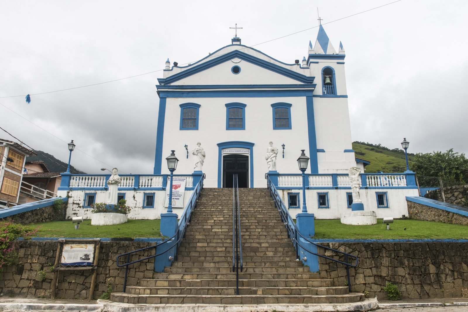
This is the heart of the island. It has the Igreja Matriz de Nossa Senhora d’Ajuda, the main church at the top of a flight of steps, streets of old houses, shops, ice cream parlors, bars and the largest cluster of restaurants. Praia da Vila and the pier are here. It is the best base without a car, for couples and for anyone who wants to go out at night. The downside is parking, which is hard at night and on holidays.
Saco da Capela, Itaguaçu and Perequê
These neighborhoods sit between the ferry and the Vila, with long-established hotels facing the channel, the Ilhabela Yacht Club, supermarkets and services. Perequê, close to the ferry landing, has shops, the island’s most urban beach and plenty of restaurants. Barra Velha, where the ferry docks, is more a place to pass through than to stay.
The south: Feiticeira, Julião, Praia Grande and Curral
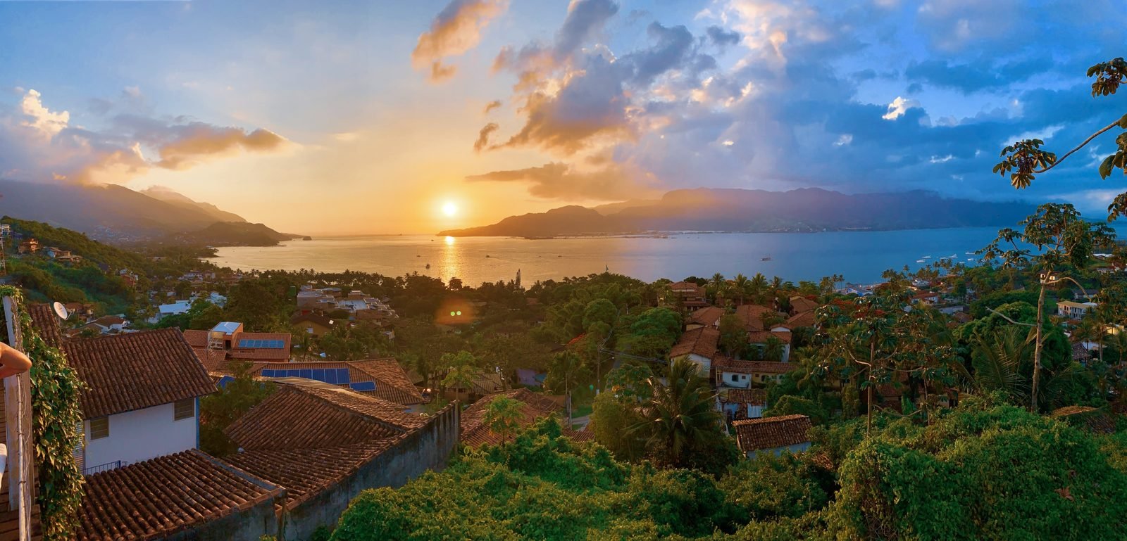
The most popular area in summer. The road follows the channel down to Curral and Veloso, the last beach you can drive to on this side. The beaches are sheltered, with calm water, and several have kiosks and bars. Curral, about 8.5 km from the ferry, has bars with tables on the sand and one of the island’s best sunsets. It is the best area for families with kids and for a beach every day.
The north: Viana, Siriúba, Piúva, Armação and Pacuíba
The north is more residential, with small, quiet beaches, gated communities and guesthouses facing the sea. Praia do Viana and Siriúba are close to the Vila. Farther north are Armação and Pacuíba, the latter about 4 km past the end of the asphalt on a dirt road. A good choice if you have a car and want peace and quiet.
Bonete, Castelhanos and remote beaches
Bonete, in the south, and Castelhanos, in the east, have caiçara communities and a few simple places to stay. No paved road reaches them. Bonete is reached by trail or boat, and Castelhanos by 4×4 or boat. Infrastructure is that of an isolated village: power and phone signal can be limited, and at Castelhanos the beach shacks run on generators. Great for a night or two, not for the whole trip if you want to see the rest of the island.
Weather and the best time to visit Ilhabela
Direct answer: for most travelers, the best time to visit Ilhabela is April to June or August to mid-September. It is drier, the temperature is pleasant, there are fewer borrachudos and the ferry lines are shorter. Summer, from December to March, is peak season, with warmer sea, bigger crowds and more rain, and January is the wettest month.
Ilhabela has a tropical climate, with an average annual temperature of around 23 °C (73 °F) and about 1,646 mm of rain a year, according to figures compiled on Wikipedia. The island’s mountains trap moisture coming off the ocean, so it rains more on the east side and on the high ground than in the Vila. City Hall divides the year into four distinct seasons, with reference temperature ranges:
| Season | Reference temperature | What it’s like |
|---|---|---|
| Summer (December to March) | 24 °C to 31 °C (75–88 °F) | Heat, warmer sea and late-afternoon showers. January is the wettest month. Christmas to Carnival is peak season, with higher prices and ferry lines. |
| Autumn (March to June) | 19 °C to 26 °C (66–79 °F) | Sunny days, less rain, sea still good for swimming. Food festivals and fewer crowds. |
| Winter (June to September) | 16 °C to 24 °C (61–75 °F) | Drier, cool nights, clear skies for trails and viewpoints. Whale and dolphin season in the channel. |
| Spring (September to December) | 19 °C to 28 °C (66–82 °F) | Heat returns, rain gradually increases, sailing and adventure sports competitions. |
Source: Ilhabela City Hall, page on the town’s climate. These are reference ranges, not official weather-station averages.
Month by month, in a nutshell
City Hall says high season follows the warm months, in spring and summer, peaking between Christmas and Carnival. The quieter low season runs from autumn through winter. According to Wikipedia, the warmest month is February, with highs of 30 °C (86 °F), and the coldest is July, with lows of 15 °C (59 °F). July sits in between: there are school holidays and the International Sailing Week, which fills the Vila, but the weather is usually dry and good for hiking.
- January and February: hot, crowded beaches, warm sea and frequent afternoon rain. Book ahead and use the ferry reservation system.
- March: still hot, crowds drop after Carnival, and the Squid Festival takes place.
- April to June: probably the best balance of weather, price and peace. April has the Bossa e Choro music festival, May the Sardine Festival, and autumn also brings the Caiçara Culture Week, with the Congada de São Benedito, the island’s main cultural tradition.
- July: winter school holidays, the International Sailing Week and the Mullet Festival. Cold nights by beach standards.
- August and September: dry with clear skies. August has the Shrimp Festival, and 3 September is the town’s anniversary.
- October and November: spring brings competitions, such as the Copa Brasil de Vela sailing regatta in October and running and swimming races in November, including the channel swim.
- December: the start of high season, with Christmas and New Year’s Eve on the channel.
Whales and dolphins
From May, humpback whales, Franciscana dolphins and other dolphins pass through the São Sebastião Channel and the open sea on their migration route. According to City Hall, sightings peak in July and August. Whale-watching boat trips leave from the Vila and Perequê. Choose operators that keep the minimum distance from the animals and don’t chase the pods.
Borrachudos and the time of year
The borrachudo, a tiny black fly that bites during the day, is most common in the hot, humid months and near rivers and waterfalls. It is no reason to skip the island, but it is a reason to pack repellent. See the safety section below for City Hall’s advice.
How to get to Ilhabela
Direct answer: Ilhabela is about 200 km from São Paulo, roughly 3.5 hours by car without traffic, via the Ayrton Senna or Dutra highways to the Tamoios Highway (SP-099), which descends the mountains to Caraguatatuba and continues on the bypass to the São Sebastião ferry. The crossing takes 20 to 30 minutes. By bus, Pássaro Marron runs from São Paulo’s Tietê Bus Terminal and Guarulhos Airport to São Sebastião, and from there you cross on foot.
Ilhabela has no commercial airport and no bridge. Everyone who arrives by car takes the ferry, and bus travelers cross on foot, free of charge, on the same boat.
By car from São Paulo
The route recommended by City Hall leaves São Paulo on the Ayrton Senna Highway (or the Dutra), continues to São José dos Campos and takes the Tamoios Highway, SP-099. Recent works gave the Tamoios new tunnels on the mountain stretch, and at the bottom, the Caraguatatuba and São Sebastião bypass skirts the neighborhoods of both towns and leads straight to the ferry port, according to City Hall. The distance from São Paulo to Ilhabela is about 200 km, and Wikipedia records 212 km from the state capital to the town. Allow about 3.5 hours without traffic to the ferry, and much more on the Friday before a long weekend.
The alternative is the Rio-Santos road (BR-101), useful if you are coming from Santos, Bertioga or Rio de Janeiro, but slower, with lots of bends and towns to drive through. If you are coming from Rio, you can combine the trip with Paraty and Ubatuba, both on the way.
By bus
Viação Pássaro Marron sells tickets from the Tietê Bus Terminal in São Paulo to São Sebastião, and runs an express line from Guarulhos International Airport, according to City Hall. In São Sebastião, walk to the ferry landing in the town center. Crossing on foot is free. On the Ilhabela side there are taxis by the ferry, ride-hailing apps and the municipal bus. Schedules and fares change with the season, so check directly with the company before buying.
By plane
City Hall lists São Paulo’s Guarulhos International Airport and Congonhas Airport as the gateways by air. From there, you continue by road. At Guarulhos, the Pássaro Marron ticket office is in the Terminal 2 East arrivals area. From Congonhas, the advice is to go to the Tietê Bus Terminal and catch the bus there. If you are combining Ilhabela with other destinations, our São Paulo travel guide, the list of best day trips from São Paulo and our guide to getting around Brazil will help you plan.
The São Sebastião–Ilhabela ferry: fares, schedule and tips
Direct answer: the ferry between São Sebastião and Ilhabela runs 24 hours a day, with departures roughly every 30 minutes from 5:30 a.m. to 11:30 p.m. and longer gaps overnight. The crossing is about 800 meters and takes 20 to 30 minutes. A car pays R$ 19 on weekdays and R$ 28.50 on weekends and public holidays, on the way in only. Foot passengers and cyclists ride free.
The crossing is run by the Waterways Department of SEMIL, São Paulo state’s Department of Environment, Infrastructure and Logistics. The information below was checked on City Hall’s website and the state services portal in October 2026.
| Vehicle | Weekdays | Saturdays, Sundays and public holidays |
|---|---|---|
| Cars and pickups | R$ 19.00 | R$ 28.50 |
| Motorcycles and similar | R$ 9.50 | R$ 14.20 |
| Cars and pickups with a trailer | R$ 38.00 | R$ 56.90 |
| Buses and 2-axle trucks, trailers | R$ 66.30 | R$ 99.40 |
| Pedestrians and cyclists | free | free |
Source: Ilhabela City Hall and SEMIL, fares in force in October 2026.
How to pay
The fare is charged only once, when you board in São Sebastião. The return trip is free. At the booth, you pay in cash or with an electronic toll tag such as Sem Parar, ConectCar, Veloe, Move Mais or Taggy. Credit and debit cards are not accepted in the regular line, according to City Hall. Bring small bills or an active tag, which saves a lot of hassle.
Hora Marcada: booking a crossing
To skip the line, there is the Hora Marcada system, which reserves a crossing time. It is paid by credit card and costs much more than the regular fare: about R$ 65.30 on weekdays and R$ 98 on weekends and public holidays, according to City Hall. On long holiday weekends, when the wait can run to hours, it is usually worth every centavo. The phone number given for the service is +55 13 3358-2743.
Lines, cameras and timing
The SEMIL portal shows live images of the line on both sides, which helps you decide when to leave. City Hall’s own tip is to cross after 8 p.m., when the line is usually much shorter. On the way back, avoid Sunday afternoon and the last day of a holiday. Motorcycles have their own line. On board, you can stay in your car with the engine off and your seatbelt unfastened. The ferries have accessible bathrooms, but City Hall itself recommends using the bathroom before or after the crossing.
Where to board
In São Sebastião, the ferry leaves from Avenida Antônio Januário do Nascimento, in the town center. In Ilhabela, the terminal is in the Barra Velha neighborhood, at the entrance to town. Foot passengers and cyclists cross for free and don’t have to face the car line.
Ilhabela environmental fee (TPA) and other entry rules
Direct answer: since 31 March 2026, Ilhabela has charged an Environmental Preservation Fee (Taxa de Preservação Ambiental, TPA) on visiting vehicles. It is a single charge per entry, however many days you stay: R$ 10 for motorcycles, R$ 48 for cars, SUVs and minivans, R$ 70 for vans and trucks, R$ 100 for minibuses and R$ 140 for buses. Pedestrians don’t pay, and vehicles registered in Ilhabela and São Sebastião are exempt.
The fee was created to fund environmental conservation and infrastructure on an island that receives far more cars than its roads can handle. You can pay by electronic tag, Pix (Brazil’s instant payment system), card or bank slip (boleto). If you have no tag, go to the official website, enter the vehicle’s license plate and issue the payment slip, with up to 30 days to pay, according to g1. For questions, there is the TPA Operations and Service Center at Rua Paraíba, 227, in Barra Velha, right at the entrance to town.
| Vehicle type | Fee per entry |
|---|---|
| Motorcycles | R$ 10 |
| Cars, SUVs and minivans | R$ 48 |
| Vans and trucks | R$ 70 |
| Minibuses | R$ 100 |
| Buses | R$ 140 |
Source: Ilhabela City Hall, official Environmental Preservation Fee page, and g1, 31 March 2026.
What it costs to drive in, all told
For a car on a weekend, the entry bill comes to R$ 28.50 for the ferry plus R$ 48 TPA, or R$ 76.50, not counting fuel and highway tolls. On a weekday, R$ 19 plus R$ 48, or R$ 67. With Hora Marcada on a weekend, the ferry goes up to about R$ 98. Travelers without a car, arriving by bus, pay neither.
Should you bring a car?
It depends on your plans. To stay in the Vila and the south, you can manage with buses, the Aquabus, taxis and local ride-hailing apps. To explore the north, the waterfalls scattered around the island and the start of the Bonete Trail, a car makes life much easier. For Castelhanos, a regular car won’t do: only licensed 4×4 jeeps, or a boat. A good alternative is to leave the car on the São Sebastião side and cross on foot, especially on holiday weekends.
Getting around Ilhabela
Direct answer: SP-131 is the only paved road and runs along the channel side, from the north to the south of the island. You can get around by car, municipal bus, Aquabus (the town’s boat service), taxi, ride-hailing apps authorized by City Hall, bicycle or e-scooter, using the bike lanes. For the east side, including Castelhanos and Bonete, it is jeep, trail or boat only.
Bus and Aquabus
The municipal bus, run by Expresso Fênix, links the ferry landing with the Vila and the beaches in the north and south. It accepts cash and the company’s own card. The Aquabus is the town’s water transport and connects the central area with some beaches in the north and south. On it, only the electronic card and single tickets sold at authorized outlets are valid. City Hall publishes the Aquabus timetable on its official website.
Taxis, apps and scooters
City Hall publishes the list of ride-hailing companies authorized to operate on the island, and there are e-scooter rentals near the ferry landing. Taxis have stands around town, including next to the ferry. Cycling works well on the flat stretch between Perequê and the Vila, but the road is narrow and has little shoulder in many places.
Driving, parking and the road
With a car, the whole island is within reach, but there are two things to watch. The first is parking in the Vila, which gets hard at night and in high season. The second is SP-131 itself: narrow, winding and with lots of people walking on the shoulder. To the south, the asphalt ends near Sepituba, where the Bonete Trail begins. To the north, the road continues to the beaches beyond Armação, and the final stretch is dirt.
Castelhanos: how to get there, rules and what to expect
Direct answer: Castelhanos Beach is on Ilhabela’s ocean side and can only be reached by sea or along the Castelhanos Park Road, a 17 km dirt road that crosses the State Park. Only 4×4 vehicles are allowed, with restricted hours and a gated checkpoint. Most people go on a licensed tour jeep, or by boat from the Vila or Perequê.
Castelhanos is the beach many people picture when they think of Ilhabela: a wide, heart-shaped bay with about 2 km of sand, open sea and Atlantic Forest running down to the beach. According to Wikipedia, it is also the only beach on the ocean side that can be reached by vehicle, and one of the cleanest in the state. A caiçara community lives there, and the beach shacks run on generators.
The Park Road rules
The road is managed by the Fundação Florestal, inside the State Park. According to reporting by Estadão, a 2014 regulation limits traffic to 65 tour jeeps a day, plus 42 cars and 60 motorcycles belonging to registered residents. Each jeep carries 6 to 10 people. In 2026 the foundation set up a working group to review these rules; jeep operators have asked for the limit to rise to 80 or 85 vehicles, and City Hall has a plan to pave the road with blocks, which divides the community. In other words, the rules may change, so confirm with your tour operator before you go.
In practice this means three things. Regular cars can’t use the road. In high season, jeep places sell out early, so book ahead. And the return time is fixed, so that every vehicle leaves the park before it closes.
By boat or on foot
Boat trips to Castelhanos usually round the north or south tip of the island and depend on the sea, which is open and can get rough. On foot or by bike, the Park Road is 34 km round trip and rated difficult by City Hall, with a guide recommended. There is also the Castelhanos–Bonete trek, 18 km and 8 to 12 hours, which passes viewpoints and six caiçara communities and requires fitness, prior authorization and a guide.
Things to do in Ilhabela
Direct answer: the best plan in Ilhabela mixes channel beaches such as Curral, Feiticeira and Jabaquara with at least one day on the wild side (Castelhanos or Bonete), one or two waterfalls such as Água Branca and Toca, a walk around the Vila’s historic center and, if you are into it, a dive on one of the shipwrecks. In winter, add a whale and dolphin watching trip.
The island has about 45 main beaches, according to Wikipedia, and dozens of waterfalls, and it is easy to try to see everything and spend the whole day on the road. Better to pick one area per day.
Beaches in the south
The south has the liveliest beaches you can drive to. Praia do Curral, about 8.5 km from the ferry, has more than 400 meters of flat sand, bars with tables on the beach, showers and parking, and a lovely sunset over the channel. Near its right-hand point lies the wreck of the Aymoré, good for beginner divers. Feiticeira, about 200 meters from the road, is small, with two waterfalls and the ruins of an old sugar mill, and holds the legend of Maria Perpétua, who is said to have buried a treasure there. Julião, reached by a 300-meter path, is good for snorkeling around two islets where seabirds nest; landing on them is not allowed. Praia Grande is the longest beach on the channel side, at about 600 meters, with kiosks and water that gets deep quickly. Veloso, the last beach in the south you can reach by car, is 300 meters past Curral, with calm water that attracts divers.
Beaches in the north
The north is quieter and the sea is usually calm. Praia do Jabaquara is one of the best known in the area, and between it and Praia do Poço lies Praia da Fome, ideal for diving, reached by a trail with two waterfalls or by sea. Pacuíba, narrow and rocky, is about 4 km past the end of the asphalt and still has working fishermen. Along the way are Armação, Siriúba, Viana and Garapocaia.
Beaches in the center
Between the ferry and the Vila are Perequê, Barra Velha, Itaguaçu, Saco da Capela and Praia da Vila itself. These are town beaches, fine for a quick swim, water sports and sunset, but they are not the reason for the trip.
Bonete: the most isolated caiçara village
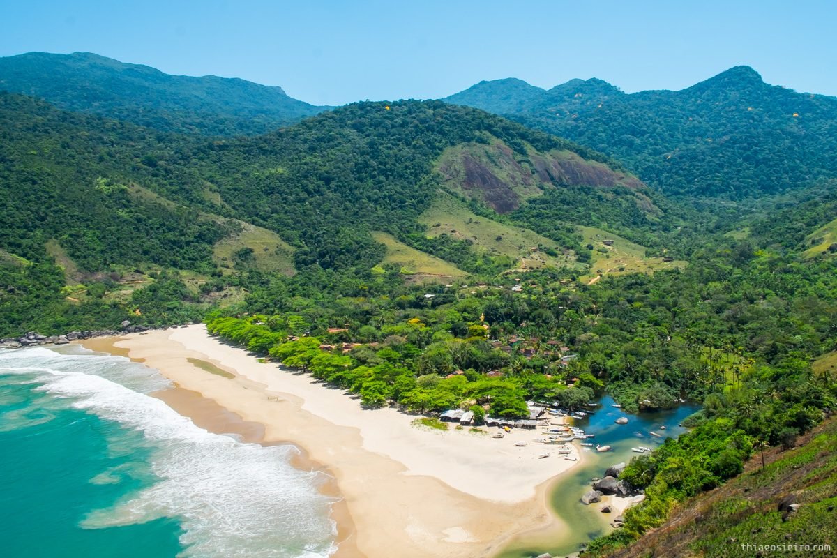
Bonete is a beach of about 600 meters at the island’s southern tip, with a community of roughly 300 residents, good surf and no road. Britain’s The Guardian named it one of the most beautiful beaches in Brazil in 2009, according to Wikipedia. You can get there by boat or on the Bonete Trail, which starts at the end of the road in the south, past Sepituba.
The trail is 23 to 24 km round trip and passes three waterfalls: Laje, with natural pools, Areado and Saquinho. Time estimates vary by source: City Hall says 4 to 6 hours round trip, and the state’s Protected Areas Guide says 7.5 to 8 hours. In practice, set aside a full day, or sleep in Bonete and walk back the next day. A guide is recommended, and there is a checkpoint at the trailhead. According to the Protected Areas Guide, entry to the trail is allowed from 7 a.m. to 2 p.m. every day, with a cap of 980 people a day. For just a taste, walk to Cachoeira da Laje, 4.6 km round trip.
In Bonete, facilities are basic, with a few guesthouses and caiçara restaurants. Phone signal and power can be limited, so download maps and bring cash.
Waterfalls
Ilhabela has dozens of waterfalls, and many of them require a licensed guide. City Hall lists these among the most popular trails:
| Trail | Length (round trip) | Time | Difficulty | Guide |
|---|---|---|---|---|
| Pancada d’Água Waterfall (Três Tombos) | 720 m | up to 1 h | easy | mandatory |
| Água Branca Waterfall | about 3.6 km | about 2 h | easy to moderate | not stated |
| Veloso Waterfall | 2.4 km | up to 2.5 h | low | mandatory |
| Friagem Waterfall | 4.1 km | up to 2.5 h | moderate | mandatory |
| Laje Waterfall | about 4.6 km | about 2 h | high | recommended |
| Couro do Boi Waterfall | 3 km | about 2 h | high | mandatory |
| Bananal Waterfall | 5 km | about 3 h | high | mandatory |
| Pico do Baepi | 7.4 km | 5.5 to 6 h | difficult | mandatory |
| Bonete Trail | 24 km | 4 to 6 h | difficult | recommended |
| Castelhanos–Bonete trek | 18 km | 8 to 12 h | high | mandatory |
Source: Ilhabela City Hall, February 2026.
Água Branca has the best facilities: the trail is signposted and passes five pools, called Pedra, Escada, Ducha, Jequitibá and Jabuti. Cachoeira da Toca, opened to visitors in 1967 by the Belgian agronomist Joseph Albert Van Sebroeck, is on a private farm, Fazenda da Toca, with paid admission. Check prices and opening hours on its official website before you go. Veloso, in the south, drops more than 30 meters, Friagem, in the north, about 25 meters, and Couro do Boi about 50 meters, on slippery ground.
Pico do Baepi
Baepi is the peak that dominates the view from the Vila, rising more than 1,000 meters. The trail starts in a patch of sapê grassland, passes a viewpoint overlooking the channel, the Serra do Mar and the Alcatrazes archipelago, and continues through the forest to the summit. City Hall gives 7.4 km round trip and 5.5 to 6 hours, with a mandatory guide. It is one of the toughest hikes on the island, but the view from the top makes up for it.
The Vila and the historic center
The Vila is the historic center and the best place for an evening stroll. Start at the Igreja Matriz de Nossa Senhora d’Ajuda, wander the streets of old houses and finish at the pier, where tour boats leave. There are shops, ice cream parlors, bars and restaurants, and in summer things stay lively until late. To understand the island’s bond with the sea, visit the Ilhabela Nautical Museum, opened in June 2022 in Parque da Usina, in the Água Branca neighborhood, which displays items recovered from the Príncipe de Astúrias and other wrecks.
Diving and shipwrecks
Ilhabela is one of the best-known dive destinations on the São Paulo coast. The local website A Cor da Ilha counts more than twenty shipwrecks around the archipelago and cites Ilha das Cabras as one of the ten best dive sites in Brazil, according to the Quatro Rodas travel guide. Ilha das Cabras, opposite Pedras Miúdas, is an ecological sanctuary with a statue of Neptune about 7 meters down, where many people do their first-ever dive.
Some well-known wrecks, with reference data from the same website:
- Aymoré (1920): a cargo ship near the point of Praia do Curral, about 30 meters from shore, shallow and suitable for beginners.
- Dart (1884): a British Royal Mail sail-and-steam ship, sunk off Ponta da Sepituba, about 40 meters from shore.
- Velásquez (1908): a British steamer more than 150 meters long that struck Ponta da Sela, about 50 meters from shore.
- Therezina (1919): a cargo ship whose propeller is the main attraction, northeast of Borrifos.
- Príncipe de Astúrias (1916): the liner sunk off Ponta da Pirabura, on the ocean side, for experienced divers, at depths of 17 to 50 meters and usually with poor visibility.
Depths vary by source and with the tide, so treat these figures as a guide and always dive with a licensed operator.
Sailing, sports and whales
The São Sebastião Channel is one of the most traditional sailing spots in Brazil. In July, the Ilhabela International Sailing Week fills the channel with yachts. The winds also suit windsurfing and kitesurfing. In spring, the calendar includes the Copa Brasil de Vela Olímpica in October, and the Kailash Trail Run and the Channel Swim in November. For whales and dolphins, the best period is May to August, peaking in July and August.
Where to eat in Ilhabela
Direct answer: restaurants are concentrated in the Vila and Perequê, and the liveliest beach bars are on Praia do Curral. Local cooking is caiçara, with fresh fish, shrimp, squid and winter mullet. To eat well for less, look for the catch of the day and dishes meant for sharing.
Food in Ilhabela revolves around the sea. City Hall’s calendar has a festival for almost every season: Squid in March, Sardine in May, Mullet in July and Shrimp in August. Outside festival dates the advice is the same: order whatever the boat brought in that day.
In the Vila there are options for every budget, from pizzerias and ice cream parlors to seafood restaurants overlooking the channel. On Curral, the bars with tables on the sand serve sharing plates and fish dishes, with showers and parking. In Bonete and Castelhanos, caiçara beach shacks serve fried fish and simple meals. Some hotels on our list, such as Vila Kebaya, Ilha Deck and DPNY, also have restaurants open to non-guests, according to their websites. We have not included a list of restaurants with prices because we could not confirm them in up-to-date official sources. For an introduction to the country’s dishes, see our Brazilian food guide.
How much a trip to Ilhabela costs
Direct answer: the fixed entry costs for a car add up to R$ 67 on a weekday and R$ 76.50 on a weekend (ferry plus Environmental Preservation Fee). Accommodation, tours and restaurants vary a lot with the season, and a holiday can double prices. Travelers arriving by bus pay neither the ferry nor the TPA.
| Item | Reference price | Source |
|---|---|---|
| Ferry, car, weekdays | R$ 19.00 | SEMIL / City Hall |
| Ferry, car, weekends and public holidays | R$ 28.50 | SEMIL / City Hall |
| Ferry, motorcycle, weekdays / weekends | R$ 9.50 / R$ 14.20 | SEMIL / City Hall |
| Ferry Hora Marcada, car, weekdays / weekends | about R$ 65.30 / R$ 98.00 | City Hall |
| Ferry, pedestrians and cyclists | free | SEMIL / City Hall |
| TPA, car | R$ 48 per entry | City Hall |
| TPA, motorcycle | R$ 10 per entry | City Hall |
| Cachoeira da Toca | paid admission, check the website | Cachoeira da Toca |
| Jeep to Castelhanos, boats and diving | vary by operator and season | check licensed operators |
Prices checked in October 2026. Public fares are adjusted periodically.
How to spend less
- Go outside holidays and high season, from April to June or in August and September.
- Cross on a weekday, when the ferry is cheaper, and after 8 p.m., when the line is shorter.
- If you are staying in the Vila or the south, consider leaving the car in São Sebastião and crossing on foot. You save the ferry fare and the TPA.
- Share the jeep to Castelhanos with other people, since prices are usually per vehicle or per seat.
- Bring repellent and sunscreen from home. Everything costs a bit more on the island.
More money-saving advice for the whole country is in our Brazil travel tips.
Ilhabela itinerary: 2, 3 or 4 days
Direct answer: with 2 days, do the south (Curral, Feiticeira, Veloso) and the Vila. With 3, add Castelhanos by jeep or boat. With 4, include a waterfall, the north and, if you are fit, Bonete or Pico do Baepi.
Ilhabela in 2 days
- Day 1: early arrival on the ferry. Morning at Feiticeira and Julião. Lunch and afternoon at Curral, snorkeling near the Aymoré if the sea is calm. Sunset at Curral and dinner in the Vila.
- Day 2: morning at Cachoeira da Água Branca and the Nautical Museum, which are in the same area. Afternoon in the historic center and on the Vila pier. If it is a Sunday, head back after lunch to beat the worst of the line.
Ilhabela in 3 days
- Days 1 and 2: as above.
- Day 3: a full day at Castelhanos, on a licensed jeep or by boat. Book ahead in high season and confirm the return time.
Ilhabela in 4 days
- Days 1 to 3: as above.
- Day 4: pick one. For a quiet beach, the north, with Jabaquara and Pacuíba. For hikers, Bonete (start early, or stay the night) or Pico do Baepi, always with a guide. For divers, a day of boat dives to the wrecks. In winter, swap it for a whale-watching trip.
Safety in Ilhabela
Direct answer: Ilhabela is a calm place for tourists, and the main risks come from nature: open sea on the east side, long trails, slippery waterfalls, the narrow road and the borrachudos. Hire a licensed guide on trails where it is mandatory, respect the beach flags and bring repellent.
At sea
- Beaches on the channel usually have calm water, but some, like Praia Grande, get deep quickly.
- On the ocean side, at Castelhanos and Bonete, the sea is open and can have currents. Only swim where the locals do.
- Scuba diving and wreck dives only with a licensed operator.
- Keep your distance from protected islets, such as those at Julião, where landing is not allowed.
On trails and at waterfalls
- Follow the rule: a licensed environmental guide on trails where guiding is mandatory.
- Wear closed shoes, carry water and leave no trash, as City Hall recommends.
- Waterfall rocks are slippery, and water levels rise fast after heavy rain. Don’t jump into pools you don’t know.
- Start long trails early. At Bonete, entry to the trail is only allowed from 7 a.m. to 2 p.m.
Borrachudos
The borrachudo is a small biting insect typical of well-preserved Atlantic Forest, which breeds in running water such as streams and rocky rivers. Since the 1980s, City Hall has controlled it with BTI, a biological larvicide, at more than 2,300 sites treated every two weeks. Even so, it is part of island life. The municipal Health Department recommends citronella-based repellents and oily lotions, reapplied after swimming in the sea or a waterfall, and long sleeves in the late afternoon and in forested areas. If you get bitten, wash the area, use a cold compress and soothing creams, and avoid corticosteroid ointments without medical advice.
On the road and in town
- SP-131 is narrow and winding, with pedestrians and cyclists on the shoulder. Drive slowly, especially at night.
- In the Vila, take the usual precautions of any tourist town: don’t leave valuables visible in the car and stay alert in crowded places.
Useful numbers
- Emergencies: Military Police 190, ambulance (SAMU) 192, Fire Department 193.
- Tourist Information Center (Barra Velha): +55 12 3895-7220.
- Tourist Information Center (Vila): +55 12 3896-3777.
- Ilhabela State Park: +55 12 3896-2585.
- Ferry Hora Marcada: +55 13 3358-2743.
Places near Ilhabela
Direct answer: Ilhabela pairs well with the rest of São Paulo’s north coast and with Rio de Janeiro state’s Costa Verde. Ubatuba is just to the north along the Rio-Santos road, Paraty a little farther, and São Paulo and Campos do Jordão are on the way back over the mountains.
- Ubatuba: more than 100 beaches, trails and islands, to the north along the Rio-Santos road.
- Paraty: a colonial historic center, waterfalls and boat trips, already in Rio de Janeiro state.
- Ilha Grande: another island without cars, if you loved the feel of Bonete and Castelhanos.
- São Paulo: the state capital and your gateway by air.
- Campos do Jordão: the Mantiqueira mountains, a good winter combination.
- Rio de Janeiro: for those who follow the Rio-Santos road to the end.
- Búzios and Arraial do Cabo: beaches and diving on the other side of Rio.
See also our list of day trips from São Paulo.
Where to stay in Ilhabela: 10 places with official websites
Direct answer: to be within walking distance of the Vila and the historic center, look at Hotel Boutique Vila Kebaya and Maison Joly. Between the Vila and the ferry, in Saco da Capela and Itaguaçu, there are Hotel Ilhabela, Hotel Itapemar and Ilha Deck. In the north, facing calm water, Porto Pacuíba and Barra do Piúva. In the south, near Praia do Curral, DPNY Beach Hotel & SPA and Pousada Praia do Curral. And to spend the night in Bonete, Pousada Canto Bravo. The links go to each property’s official website and were checked on 28 October 2026. There are no affiliate links. The amenities mentioned are those listed on each website, and the photos in this guide are not of the hotels.
One tip before booking: ask whether the rate includes breakfast, whether there is parking and how far the nearest beach is on foot. In Ilhabela, where you sleep decides how much time you spend in the car, and SP-131 moves slowly in high season.
Hotel Boutique Vila Kebaya (boutique hotel, Vila)
Hotel Boutique Vila Kebaya is at Rua Antônio Lisboa Alves, 167, behind the Igreja Matriz, a few steps from the historic center. According to its official website, it has chalets set in the Atlantic Forest, a heated infinity pool with a hot tub and its own restaurant, with dishes such as moqueca and shrimp risotto. A good choice if you want to walk to the Vila’s restaurants and come back to somewhere quiet. Phone listed: +55 12 3896-5353, and WhatsApp +55 12 99110-0151.
Maison Joly (guesthouse with a view, historic center)
Maison Joly is at Rua Aníbal Telles Correa, 272, about 300 meters from Praia da Vila and the historic center, according to its website. The house sits up on the hill, and the website highlights sea views from every room, with rooms and suites that have, depending on the category, a jetted tub, a fireplace or a private pool. Some units accept pets. WhatsApp listed: +55 12 98244-6362.
Hotel Ilhabela (hotel, Saco da Capela)
Hotel Ilhabela is at Avenida Pedro Paula de Moraes, 151, in Saco da Capela, facing the channel and close to the Yacht Club. According to its official website, it was one of the first hotels built in the archipelago and is less than 300 meters from the Vila. Rooms have balconies with sea views, and some categories have a hot tub. Phone listed: +55 12 3896-1083.
Hotel Itapemar (leisure hotel, Saco da Capela)
Hotel Itapemar is at Avenida Pedro de Paula Moraes, 340, about 800 meters from the Vila. According to its official website, it has three pools, one of them heated, tennis and beach tennis courts, a gym, a playground, two saunas and a Mediterranean-inspired seafood restaurant. The website says one child up to 12 stays free in the room with their parents. A practical option for families. Phone listed: +55 12 3896-1329.
Ilha Deck Hotel e Restaurante (hotel and restaurant, Itaguaçu)
Ilha Deck is at Rua Dona Iza, 25, on the corner of Avenida Almirante Tamandaré, 805, in Itaguaçu. According to its website, it started in 1982 as a bar opened by Marianne and Eckard Schmidt, a couple of German origin, and today combines a hotel with a restaurant serving seafood and international food. It is one of the oldest and best-known names on the island. Phone listed: +55 12 3896-1489.
Porto Pacuíba Hotel (hotel, Praia do Viana, north)
Porto Pacuíba Hotel is at Avenida Leonardo Reale, 2392, facing Praia do Viana in the north of the island. According to its official website, the hotel was founded by the Benz family, who had been coming to Ilhabela for decades, and it highlights sustainability practices and outdoor leisure areas. A choice for those who prefer the calmer side, with gentle water and fewer crowds than the south. Phone listed: +55 12 99175-9159.
Barra do Piúva (guesthouse, Piúva, north)
Barra do Piúva is at Avenida Brasil, 1,140, in the Piúva neighborhood in the north of the island. According to its official website, it has nine suite categories with full or partial sea views, some with a hot tub, and welcomes children from age 10, which makes it an option for couples. Phones listed: +55 12 3894-9415 and WhatsApp +55 12 98840-4321.
DPNY Beach Hotel & SPA (resort, Praia do Curral)
DPNY Beach Hotel & SPA is at Avenida José Pacheco do Nascimento, 7668, on Praia do Curral in the south. According to its official website, it has 84 suites, a spa, a beach club and several restaurants, including Tróia, a bistro and a sushi lounge. It is the most complete address in the south of the island if you want resort facilities close to the Curral beach bars. Phone listed: +55 12 3894-3000, and bookings by email at reservas@dpnybeach.com.br.
Pousada Praia do Curral (guesthouse, Praia do Curral)
Pousada Praia do Curral is at Avenida José Pacheco do Nascimento, 7835, opposite Praia do Curral. According to its official website, it has an outdoor pool, a buffet breakfast from 8 to 10:30 a.m., and accepts pets up to 12 kg. For stepping out of your room straight onto the sand at guesthouse prices. Phone listed: +55 12 3894-1310.
Pousada Canto Bravo (beachfront guesthouse, Bonete)
Pousada Canto Bravo sits on the sand, facing the sea, in the middle of Praia do Bonete. According to its official website, it has 12 rooms, a restaurant and a lounge bar. Staying here is the best way to experience Bonete without rushing back along the trail the same day. Remember that you can only arrive on foot or by boat, and facilities are those of an isolated village. Contact listed: contato@pousadacantobravobonete.com.br.
Video: Ilhabela, one island, a thousand wonders
The video below was published by the Turismo Ilhabela channel on YouTube and is part of the “Uma Ilha, Mil Maravilhas” (One Island, a Thousand Wonders) campaign by Ilhabela City Hall. It is one minute of footage of beaches, waterfalls, forest and sea, with no narration.
Ilhabela FAQ
What is there to do in Ilhabela?
Combine channel beaches such as Curral, Feiticeira and Jabaquara with a day at Castelhanos or Bonete, a waterfall such as Água Branca or Toca, and a stroll around the Vila. Divers have shipwrecks and Ilha das Cabras, and from May to August there is whale and dolphin watching.
How much is the ferry to Ilhabela?
In October 2026, a car pays R$ 19 on weekdays and R$ 28.50 on weekends and public holidays, on the way in only. A motorcycle pays R$ 9.50 and R$ 14.20. Foot passengers and cyclists ride free. The Hora Marcada booking costs about R$ 65.30 on a weekday and R$ 98 on a weekend.
How much is the Ilhabela environmental fee?
The Environmental Preservation Fee, charged since 31 March 2026, is R$ 48 for cars, R$ 10 for motorcycles, R$ 70 for vans and trucks, R$ 100 for minibuses and R$ 140 for buses, once per entry. Pedestrians and vehicles registered in Ilhabela and São Sebastião don’t pay.
When is the best time to visit Ilhabela?
April to June and August to mid-September, when there is less rain, fewer borrachudos and shorter ferry lines. Summer is high season, with warmer sea, more rain and higher prices.
How do I get to Ilhabela from São Paulo?
By car, take the Ayrton Senna or Dutra highway to the Tamoios Highway and the bypass to the São Sebastião ferry, about 3.5 hours without traffic. By bus, take Pássaro Marron from the Tietê Bus Terminal or Guarulhos Airport to São Sebastião, then cross on the ferry on foot.
Do I need a car in Ilhabela?
It isn’t essential. Buses, the Aquabus, taxis and ride-hailing apps cover the Vila and the channel beaches. A car helps for the north, the waterfalls and the Bonete Trail. For Castelhanos, a regular car won’t do: only a licensed 4×4 jeep or a boat.
How do I get to Castelhanos Beach?
Along the Castelhanos Park Road, a 17 km dirt road open only to 4×4 vehicles at controlled times, or by boat. Most people go on a licensed tour jeep. The limit is 65 tour jeeps a day, so book early in high season.
How do I get to Bonete?
On foot, along the Bonete Trail, which starts at the end of the road in the south, or by boat. The trail is 23 to 24 km round trip and passes three waterfalls. Time estimates range from 4 to 8 hours round trip, so many people spend the night in Bonete.
Are there a lot of borrachudos in Ilhabela?
Yes, especially near rivers and waterfalls and in the hot months. City Hall runs biological control at more than 2,300 sites but recommends repellent reapplied after swimming and long clothes in the late afternoon.
How many days should I spend in Ilhabela?
Three days is a good minimum: one for the south and the Vila, one for waterfalls and one for Castelhanos. With four or five, you can add the north, Bonete, Pico do Baepi or a day of diving.
Is Ilhabela worth visiting?
Yes, especially if you like nature with comfort close at hand. Few places this close to São Paulo bring together such well-preserved Atlantic Forest, waterfalls, calm and open-sea beaches, caiçara villages with no road and shipwrecks to dive. The price is logistics: the ferry, the environmental fee, the narrow road and the borrachudos all call for planning. Go outside holidays, reach the ferry early or at night, pack repellent and save a day for the island’s wild side. It is there, at Castelhanos or Bonete, that Ilhabela shows why so many people keep coming back.
Sources
- Ilhabela City Hall: Environmental Preservation Fee
- Ilhabela City Hall: how the ferry crossing works
- Ilhabela City Hall: how to get there
- Ilhabela City Hall: climate
- Ilhabela City Hall: best time to visit, month by month
- Ilhabela City Hall: trails
- Ilhabela City Hall: borrachudo control
- Ilhabela City Hall: 100 years since the Príncipe de Astúrias wreck
- Ilhabela City Hall: useful information
- SEMIL (São Paulo state): São Sebastião–Ilhabela crossing
- São Paulo Protected Areas Guide: Ilhabela State Park
- São Paulo Protected Areas Guide: Bonete Trail
- g1: Ilhabela environmental fee (in Portuguese)
- Estadão: road plans and jeeps at Castelhanos (in Portuguese)
- BBC News Brasil: the sinking of the Príncipe de Astúrias (in Portuguese)
- IBGE Cidades: Ilhabela
- Wikipedia (Portuguese): Ilhabela
- Wikipedia (English): Ilhabela
- A Cor da Ilha: shipwrecks and diving
- Cachoeira da Toca (official website)